Day 93, 8/30, Silver Lake Jct, M-1271, 25mi

I’m still adjusting to how late the sun comes up down here, and obviously it’s just going to keep getting later as the equinox approaches and I hike south. I’m definitely getting more sleep 🙂

A beautiful sunrise and mild temps for the big descent into Belden, CA.

I dropped about 5000′ over 11 miles.

Belden is on the banks of the Feather River.

The town consists of one commercial building, a hotel/saloon/cafe/store which is a popular stop with hikers since we walk right by it. I hung out for about two hours and the temps were getting hot. The last couple days were 100+ down here.

The climb out of town was a tough one (4000′ in 8mi)… mostly because of the heat. There were a couple things working in my favor though: now that I’m hiking southbound the climbs tend to be north facing like this one which can provide some extra shade. There was decent tree cover on the climb (huge difference) and there was a thick haze easing the sun rays from a fire nearby (but not affecting the PCT). I was also listening to a podcast about the WWI and the horrendous conditions the soldiers had to endure in the trenches…needless to say I wasn’t complaining about my situation. The smoke obscured the views and gave off a perpetual campfire smell.

This is the view from my campsite overlooking Silver Lake. The haze just above the horizon is from the smoke.

A perfect night and location to cowboy camp.  

A respectable sunset even with the haze.

Once again, I saw next to no one on the trail…actually I think it was a zero
which might be a first. I did see a scout group breaking camp to do trail work as well as the hikers hanging out in town, but no one actually hiking!

Day 92, 8/29, Andesite Spring+, M-1296, 30mi

It was great to be back hiking on the trail again. I’ve had enough public transportation for a while. It was kind of a hot day (90+) but nothing too terrible in the shade of the trees all day. The trail wasn’t anything too exciting. The occasional giant old growth tree, some views of Lassen Peak and the typical Northern California dry climate understory (sage) as well as lots of volcanic rocks.

The official halfway point Monument was rather anticlimactic…but still with a pic.

The last time I saw Lassen back in June there was a lot more snow on it. I even got snowed on while camped there (June 10 ?).

Things can get a little hairy on Butt Mtn. even in late spring. It’s the Butt of a lot of jokes around here.

Another view with Lassen on Horizon.

More Butt jokes.

It was 23 miles today to the next on stream water source. Luckily, there was a spring that was still flowing just 1/4 mile off trail, about halfway through this stretch.

Tonight is the first night I’ve camped alone in quite a while (somewhere in Oregon ?). It’s pretty much dark by 8:00pm and in the morning it’s not light out until about 6:15 (I get to sleep a bit longer 🙂

8/26-8/28: Travel Days

I had all day Saturday and most of the day Sunday to relax in Vancouver before my flight to Reno Sunday eve, and then the a series of busses to get me back to Chester, CA where I would begin hiking Southbound picking up the 500+ miles I had skipped over due to snow and dangerous water crossings back in June.

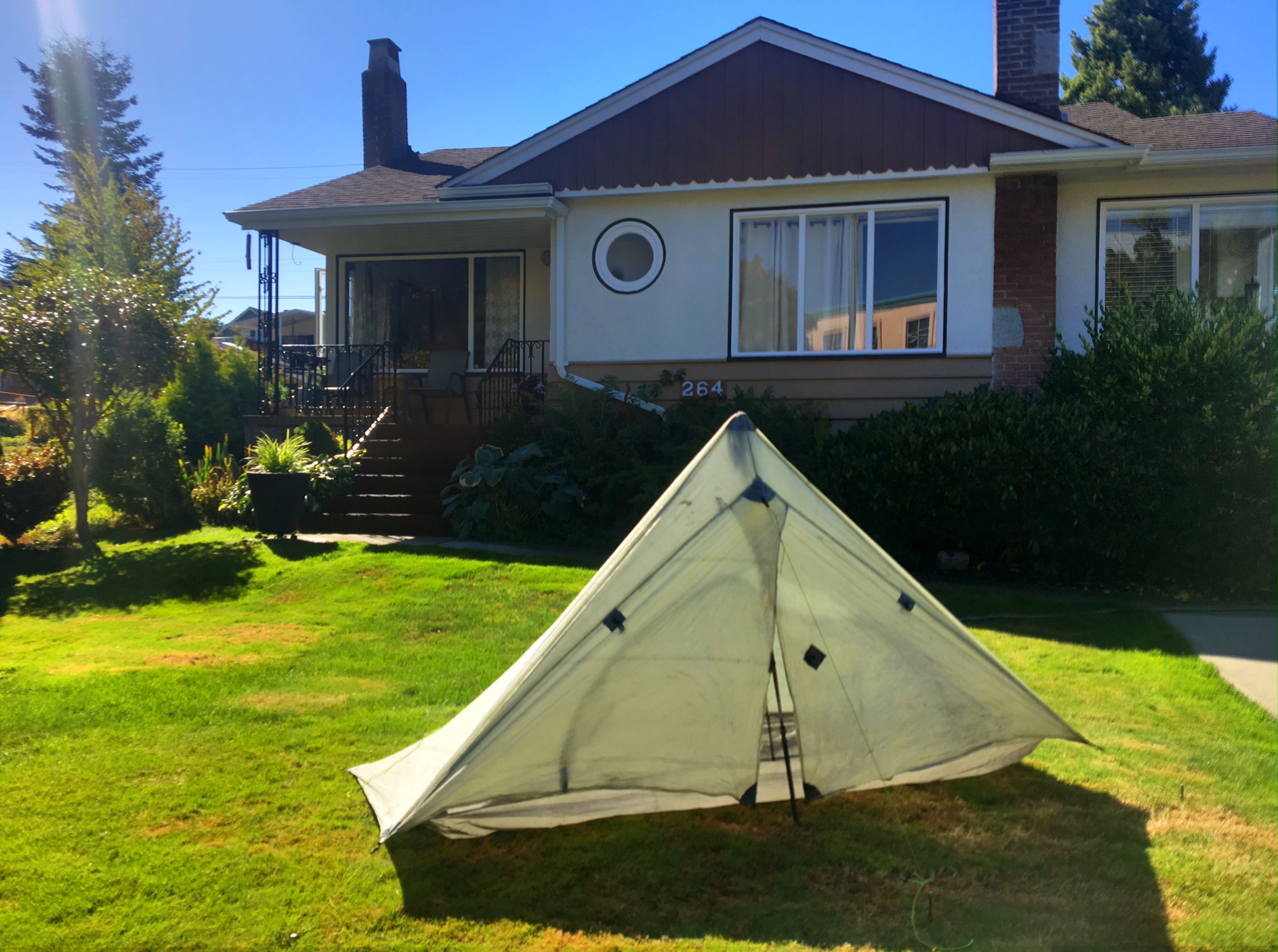
I’m sure the neighbors love the sketchy dude setting a tent up in the front yard (to dry it out).

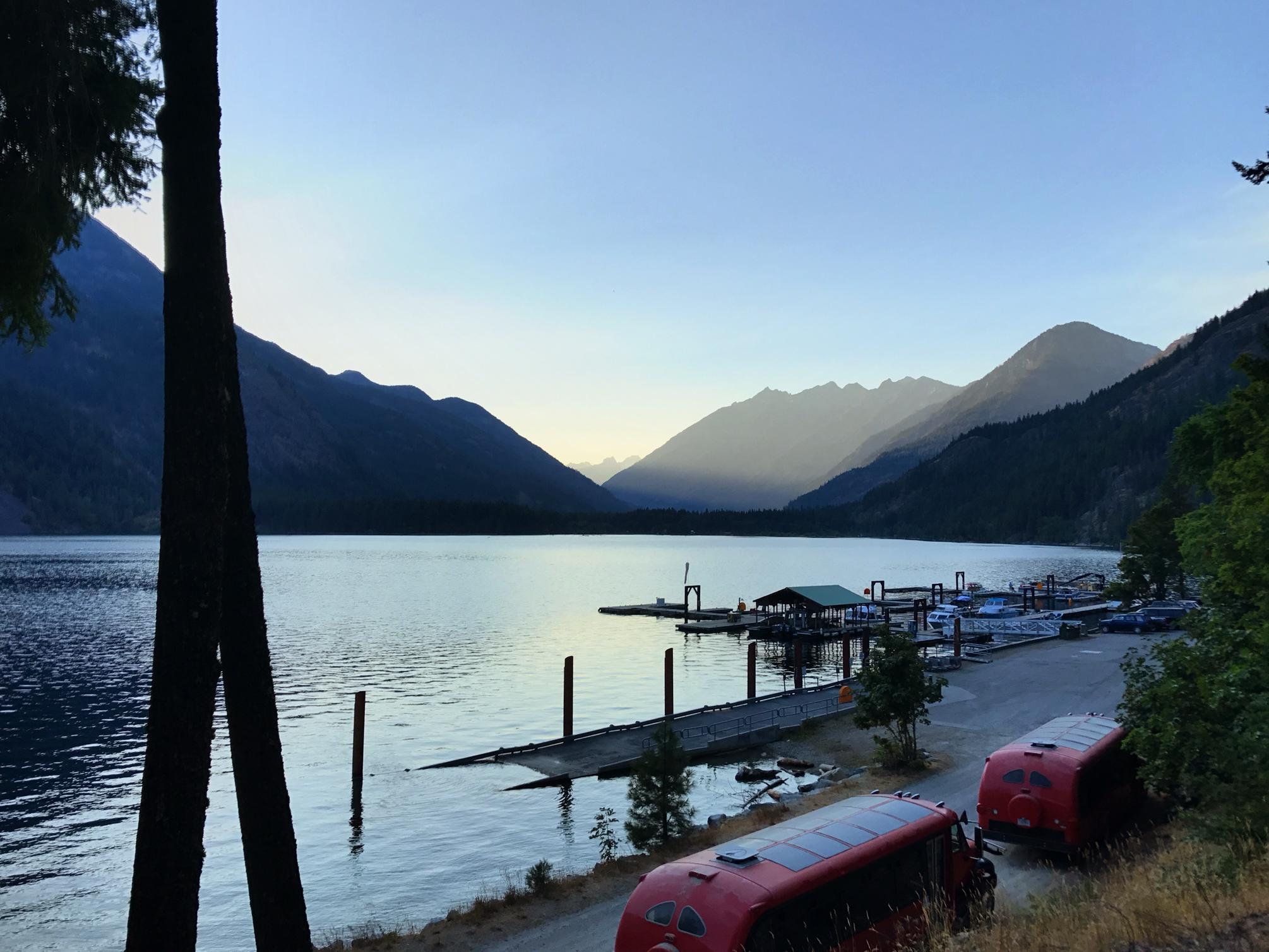
We spent half the day on Sunday cruising all over town on bikes checking out the beach and other fun stops.

Dave dropped me off at the airport around 2:30 for my 4:00 flight. And this is where all the fun begins. When I went to check in and presented my travels docs I was informed that my Passport ID Card (good for travel to/from Canada and Mexico) was only acceptable for travel by land or sea and that I’d need my full passport to travel by air with United Airlines. I showed them a copy of my Passport I had saved on my phone…no good. I informed them I was cleared for expedited immigration processing with Global Entry and was electronically fingerprinted. This perked up the rep a bit… “if you have your global entry card we can use that”. I never travel with the card because it’s not needed…they just scan your hand print. She told me my only option would to be rebooked on a flight out of Seattle…earliest flight she can get me on is in two days (Tues). Surely, there is a better option than this. Since, the USA has you go through customs/immigration before you get on the plane at the Vancouver airport I paid them a quick visit. They had no problem with my docs but I’d need a boarding pass to get through. (I had already tried online check-in) I went back to the counter with the new info I had gotten but the rep told me it was United’s “policy” and “I could lose my job if I give you a boarding pass”. I politely explained that I was willing to take that risk… no go!

I was sure there was a flight earlier than two days from now to get me from Seattle to Reno but decided it would be better to fight that battle from the SeaTtle airport. Now I just needed to get there. Luckily, I had already looked into this briefly when I was figuring out travel options originally and new there were Amtrak, Greyhound, and private bus options. This is how the rest of my travel went:

1. Train from airport to downtown Vancouver (arrive at 4:00, walk 15mins to bus/train station)
2. Amtrak at 5:30 full. Greyhounds next bus is tomorrow, Bolt bus at 5:00 says booked but they might have space, 6:30 bus says same thing. 3. 5:00 bus shows up at 6:00 and only have room to Bellingham…I’ll take it !
4. While on bus look up all the different flight options on United from Seattle to Reno. My other constraint is that the shuttle that gets me from Reno to trail (3.5hr ride) only travels on m/w/f and leaves at 1:30. So I need an early flight! Only one flight from Seattle that would work and looks pretty much booked.
5. Look into one way rental cars. Available from both Bellingham and Seattle to Reno. Only ~$70 with taxes and fees, but 12hr drive. Look into flights from other cities (Portland, Eugene) to Reno. I could drive then fly…def possibilities. 6. I wind up being able to take bus all the way to Seattle (some no shows).
7. I find a Southwest flight leaving Seattle at 5:30am and getting to Reno at 9:30am via SFO. It’s only $150 and I even have points to pay for it 🙂 8. Arrive in Seattle at 9:30pm and walk to SkyTrain to get to airport.
9. Go to United counter and try to rebook flight. The best she can do is get me in at midnight tomorrow…I take the ticket as a backup.
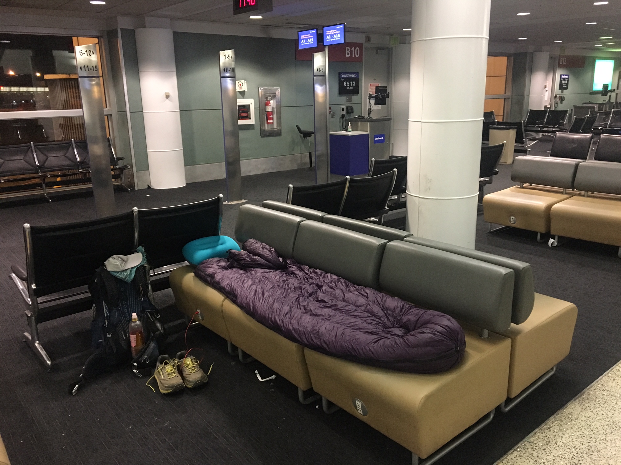
10. Bed down for the night on a comfy couch near the Southwest gate. No issues at security carrying pack with collapsed trekking poles and tent stakes. 11. 5:30 Flight to San Francisco goes smoothly
12. 8:30 flight to Reno leaves 20mins late.
13. Arrive at 9:45. Figure I might as well stop at hotel I didn’t use last night and get a shower, plus I need to pick up my resupply box that was sent there. Take free hotel shuttle. 14. Hotel agrees to let me check-in for a couple hours. They have my box 📦 🙂 15. Shower, relax, then shuttle back to Reno airport at 1:00 16. 1:30 shuttle to Susanville, CA.
17. 3:45-5:00 hotter than blazes and hangout at Walmart while waiting for next shuttle. 18. 5:15 shuttle to Chester, CA
19. 6:30 get dropped off and meet Trail Angel Jeff who will give me a ride the last 6mi to the trailhead.

I’m tired just writing this all down!

Home for the night at the Seattle Airport

All the Burning Man folk were converging on the Reno airport.

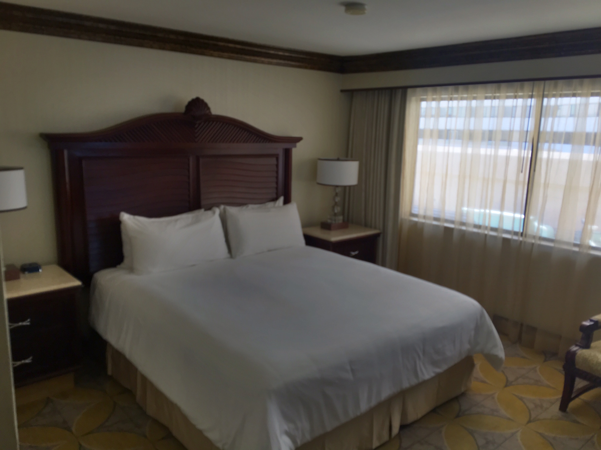
2.5 hours in my comfy hotel room.

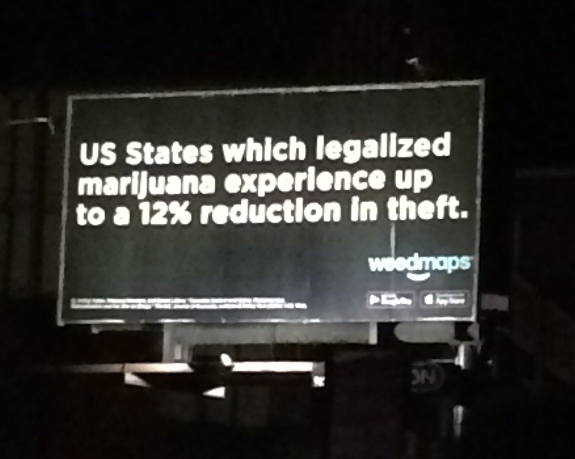
Last but not least…love the marijuana billboard propaganda in Vancouver.

Day 91, 8/25, Manning Park, M-2660, 16mi

It was an exciting morning knowing we’d be reaching Canada in just a couple hours. It was also fairly cold…not below freezing, but a damp biting chill.

He we are packing up from our last campsite.

This is our first sighting of the Border… It’s the swath cut through the trees.

…and here I am at the actual Border Monument.
(swath cut seen under Canadian flag)

Me and Darth Vada.
Here’s another dude, sporting the Stars and Stripes. The stretchy tights were cached in the metal obelisk (on the right) for anyone’s use.
It was about 9 more miles to civilization in Manning Park. The last several miles were on a dirt road.

Here’s a selfie with DV photo-bombing…kind of looks like I have a some weird horns on my hat.

We hung out at the Manning Park lodge for a while (wifi and drinks). I also made a sign to help my 200km hitch to Vancouver. I got a ride pretty quick to a town called Chilliwack an hour West… where I caught a Greyhound an hour later the rest of the way to Vancouver.

The AC on the bus crapped out, but the skylight was open and the wifi was working so all was good.

Some old friends from Denver, who live in Vancouver picked me up and I stayed with them (thanks Dave and Christine)…
…after stopping for some delicious Ice Cream.

Day 90, 8/24, Hopkins Lake, M-2644, 24mi

It was a cool morning with a biting wind… definitely felt like Fall. The ground cover is even starting to change colors at the higher elevations

Waiting for the morning sun to reach us and warm us up !

A fantastic view up above tree line.

We took some extra long siestas since we had a shorter day planned. The 1.5 hour mid-day stop with a nap in the warmth of sunshine was perfect!

Darth Vada got an “old school” text message…

It was from her dad who is doing a backpack trip in the area.

Apparently, the Llama was a bit shy and didn’t really like the downhills (he’s new to backpacking)

High meadow walking under blue skies.

The lake,1000′ below, is where we camped for the night… 6.5mi to Canada 🇨🇦!

We were excited to get in earlier than normal even with our extended siestas, arriving just after 6pm.

Unfortunately, there was a cold wind and we spent the whole evening in our tents. Not the worst thing but the lake was so pretty it would have been a perfect place to relax on the shore.

Hard to imagine the folks who are first arriving here in late Sept. and Oct, often with snow falling.

Day 89, 8/23, Harts Pass, M-2620, 29mi

Testing out last nights bear-hang. There’s no way a bear could reach that 😉

Looking back toward North Cascades National Park.

2600 Mile Mark (less 540)

The last climb (6500′ today) had some good views.

The Harts Pass Campground was full (all 5 sites) so we just pitched our tents in the woods.

A shorter day planned for tomorrow…24mi to a small lake. Only 31 mi to Canada!

Day 88, 8/22, Porcupine Creek, M-2591, 24mi

The morning was a fairly relaxed because the bus back to the trailhead doesn’t leave until 8:00 am. I didn’t sleep real well…needed to hike more miles? It was one of the warmer nights so that wasn’t helping either. Our plan was to walk the two miles to the bakery and be there by 7:30 when they opened, then we would catch the bus when it came by just after 8:00.

A calm morning on Lake Chelan.

In case a pick me up is needed on the walk to the bakery.  

 I will have to come back and do some paddling 🙂

This time I got one of the famous sticky buns… and straight out of the oven. It was phenomenal! Then had a bumpy 45min bus ride to the trailhead to shake it all up.

Houston, we have a problem! Luckily, there was a log we could use to cross just upstream.

We hiked most of the day through North Cascades National Park, the 7th and final park of the trip.

It heated up pretty good today… mid-90’s. And of course we had an exposed climb during the heat of the day that just zapped us. We took a long siesta in the shade of some pines next to a creek. The shade made a world of difference but we couldn’t lay there all day 😦 The early evening was much more comfortable and we rolled into camp around 7:15pm. Our only additional chore being the first bear-hang of the trip. The bears are fairly active in this part.

So, only two more nights before Canada 🇨🇦 …kind of hard to believe !

Day 87, 8/21, Stehekin, M-2569, 13mi

Today consisted of a quick downstream stroll to the High Bridge Ranger station where the bus to Stehekin, WA picks up hikers every couple hours. We were motivated by both the famous Stehekin Bakery (sticky buns!) and timing things so we could catch the eclipse while not buried in the (magnificent) trees. We covered the 12 miles in four hours and were in a perfect open area to view the eclipse. Unfortunately, since we would only have 90% totality it was too bright to see anything without the fancy glasses. Luckily, I remembered the pinhole trick from the last eclipse (1979) and poked a hole in a piece of cardboard then projected the light onto some paper from my journal…38 years was a long time to wait for an eclipse!

The Agnes River carving its way through a gorge.

Projecting the eclipse using a cardboard pinhole.

Lounging at the picnic tables (for 2hrs) while we wait for the bus.

A giant rattlesnake slithered across the road giving us some entertainment.

Our chariot awaits.

One of the best cinnamon rolls ever!

Hanging out it Stehekin on the shores of Lake Chelan.

Stopped by the tiny post office which was filled to the gills with hikers’ resupply boxes.

The evening sun.

This little town is only accessible by boat, float plane or foot and is surprisingly busy in the summer. Most of the afternoon was spent doing laundry, showers, organizing food, eating and relaxing. There is even free camping for hikers behind the visitors center 🙂

Day 86, 8/20, Agnes Creek, M-2757, 28mi

When we broke camp at 6:00 it was definitely chilly…probably the low 40’s. We were camped ~6000′ which is pretty high in the northern cascades. Around 7000′ you start to have glaciers on some peaks. The day was basically broken into two parts…a long descent (9mi) and then a long climb (11mi). Most of the day we were in the trees without a lot of views but there was some very impressive old growth forest we hiked through that made up for it. There was also a big milestone today…2000 MILES completed ✅. Only 660 more to go.

Sunrise from camp.

DV trying to hug a giant tree in an incredible stand of old growth forest.

An impressive bridge over Suiattle Creek. We had a mid morning siesta on the bridge because it was so nice and sunny out in the open after being buried in the coolness of the trees all morning.

Towards the top of our afternoon climb we had our last view of Glacier Peak.

Our evening descent toward Agnes Creek.

The bridge over Agnes creek had been washed out…giant trees to the rescue.

Tomorrow we will descend the final 12 miles to get to the tiny settlement of Stehekin and assess for ourselves whether or not their infamous bakery is up to the challenge of hungry hikers.

Day 85, 8/19, Dolly Vista Camp, M-2529, 26mi

We woke up in the clouds this morning and no views of the giant peaks surrounding us. It was damp but not raining and temps in the 40’s. There was a lot of climbing (and just as much descending), over 9000′ by the time the day was done. Many of these were 300O’ at a time.

Morning cascade.

There were quite a few blow downs to navigate.
Darth Vada getting low.

Luckily, there is a bridge to cross the White Chuck River, even if it is a bit compromised.
Tons of berry pickin’ along the trail.
DV filling up water at a gorgeous cascade.

Then there were the switchbacks.

This is a view across the valley of what we will soon be climbing.

Alpine lakes never get old 🙂

One of the many backcountry toilets #DeuceWithaView

Finally the clouds cleared with an incredible view of Glacier Peak.

We camped with some nice folks climbing some of the nearby peaks for the weekend.

Sunset from camp.