Day 65, 7/30, Jude Lake, M-2047, 26mi

A very interesting day with all sorts of random things going on.

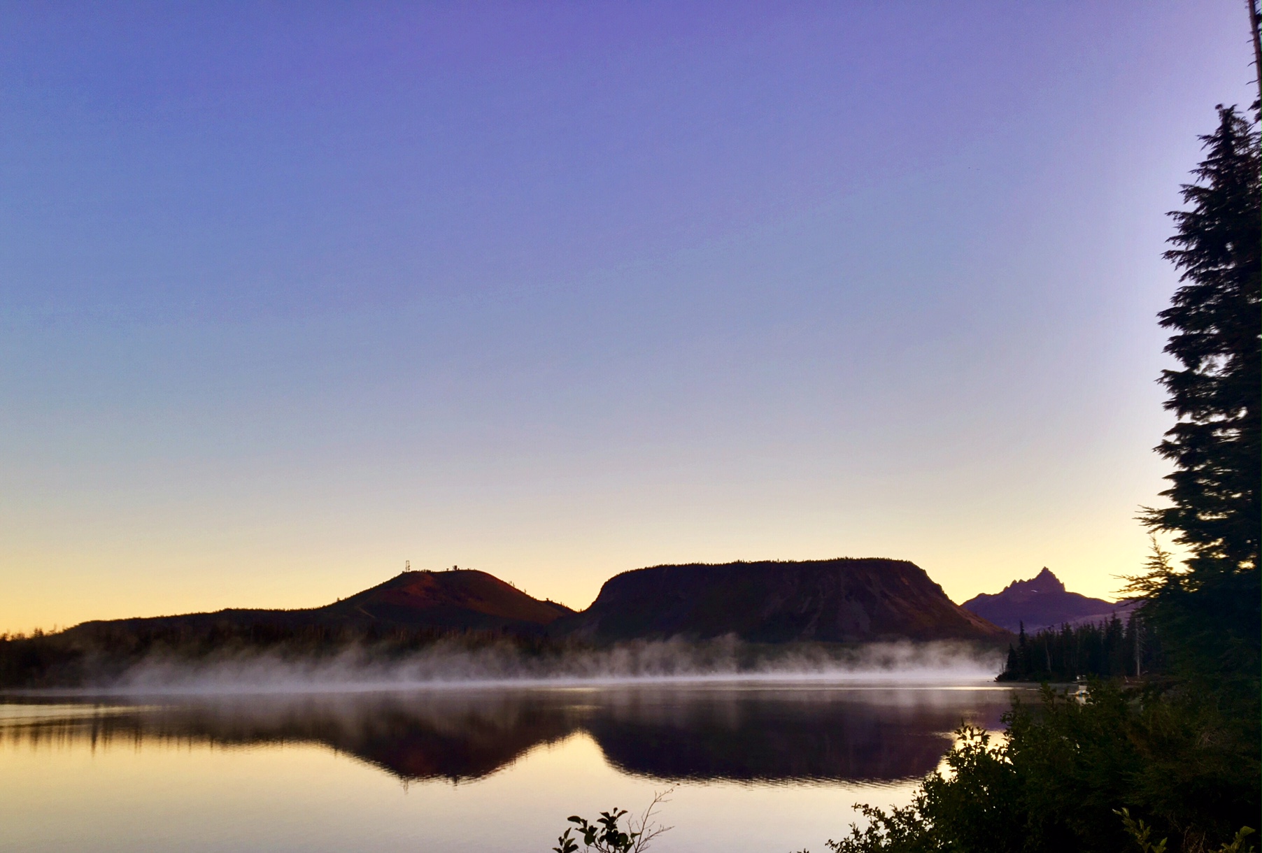
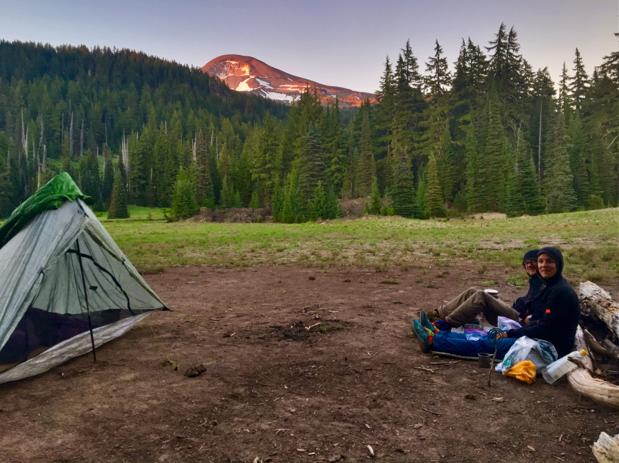
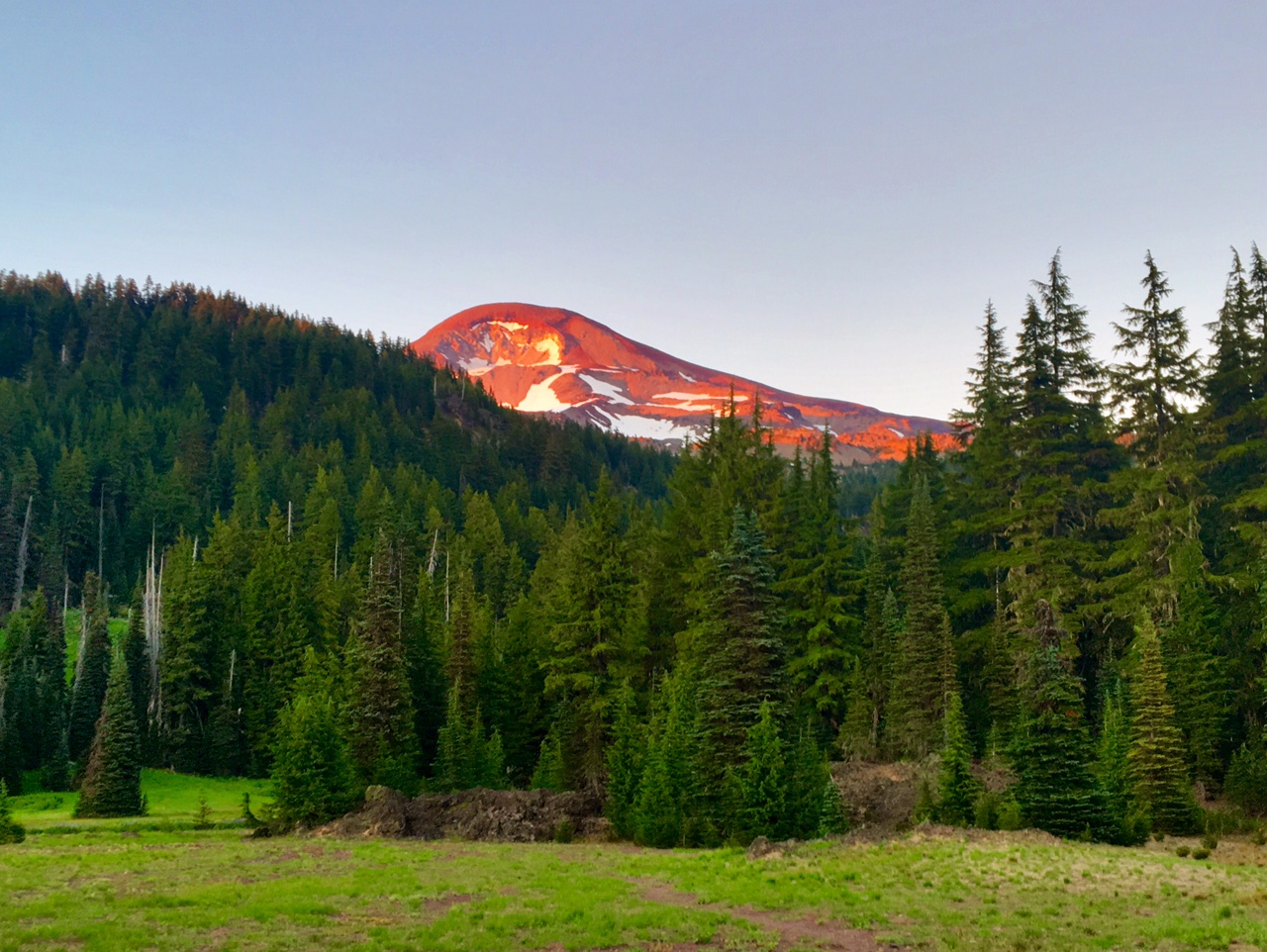
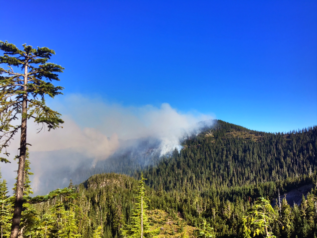
The colors in the sunrise were unfortunately being enhanced by a nearby forest fire.

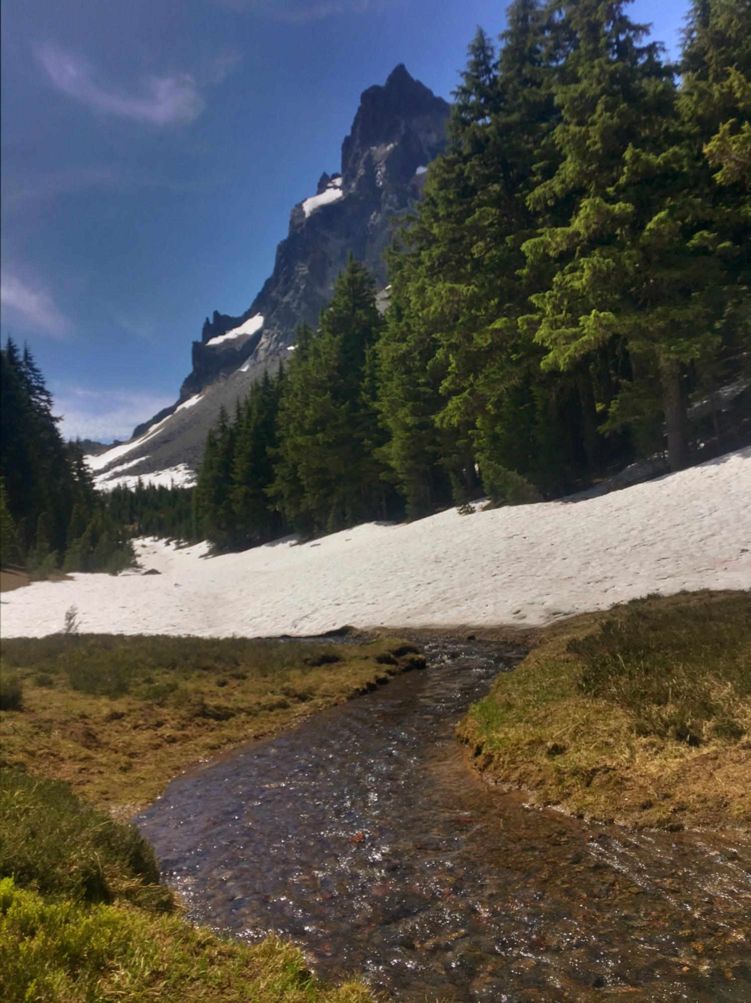
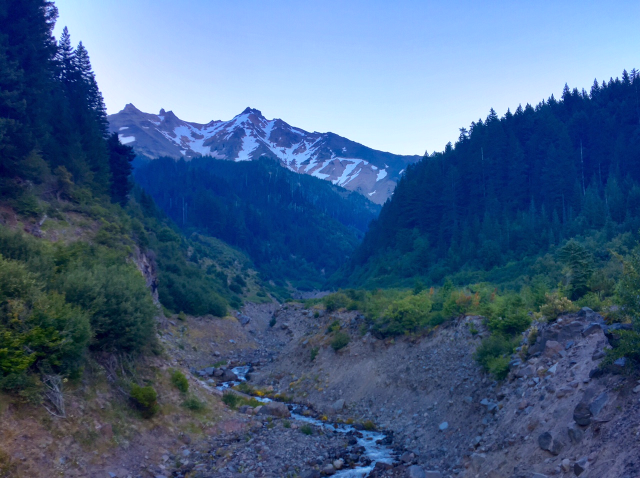
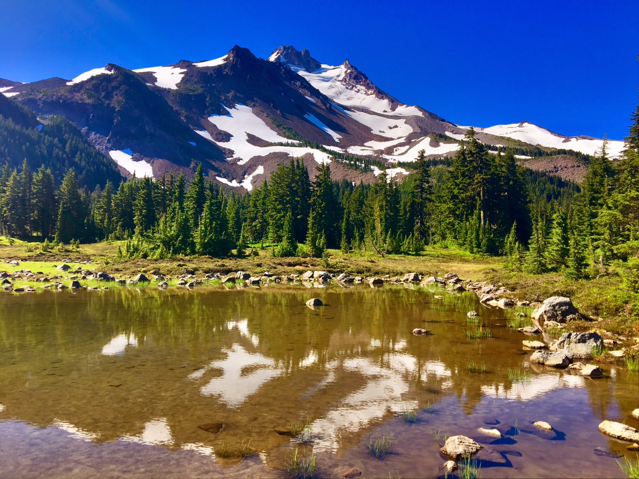
There was a wet crossing of Russell Creek which is fed by glacial runoff from Mt Jefferson (in the background). The creek was moving pretty good but nothing like the Sierras in June 🙂

It turns out that fire was getting pretty close to the PCT. Fortunately, there were personnel on the ground managing the situation.

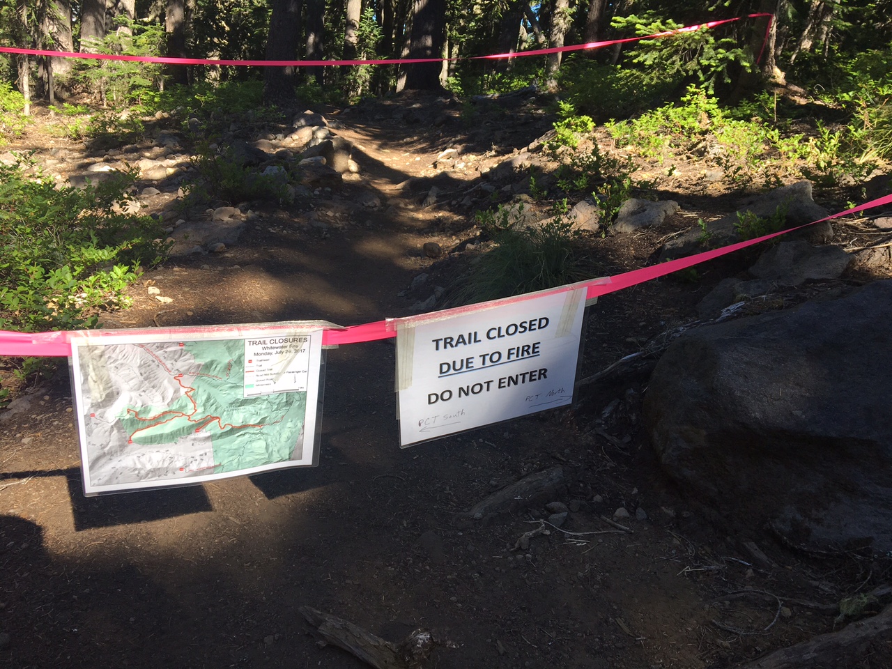
This was a side-trail that had just been closed off due to fire.

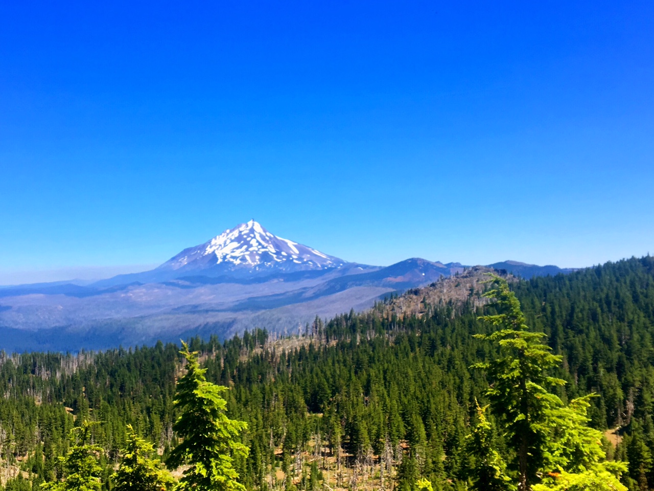
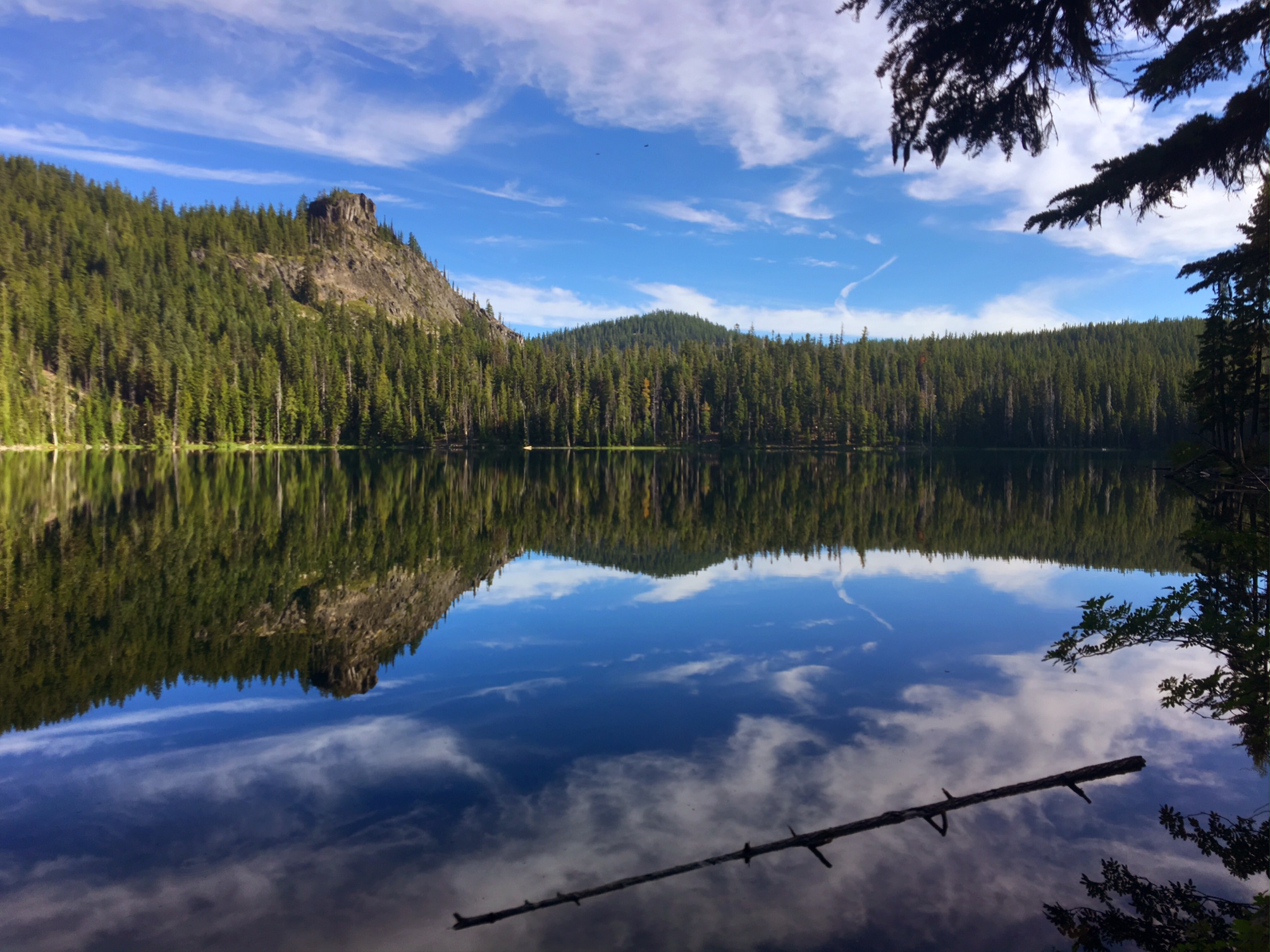
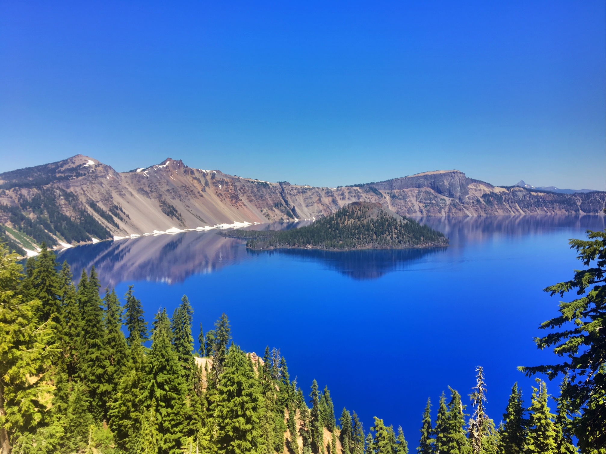
Mt Jefferson is an impressive peak towering over exquisite alpine lakes and meadows.

The wildflowers were kicking into high gear.

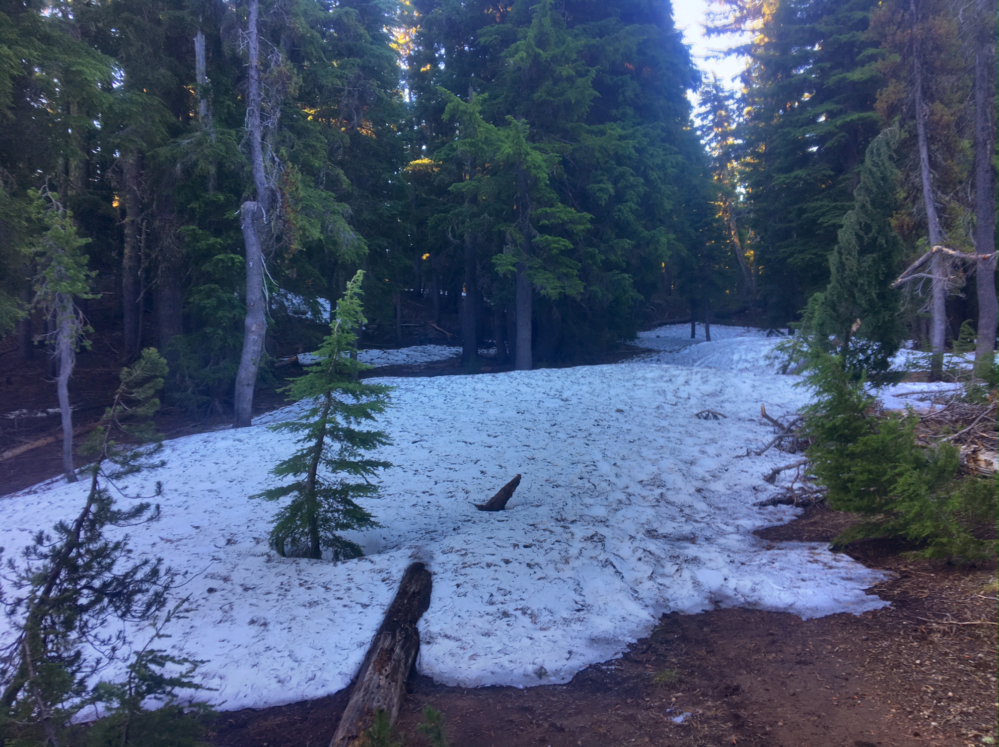
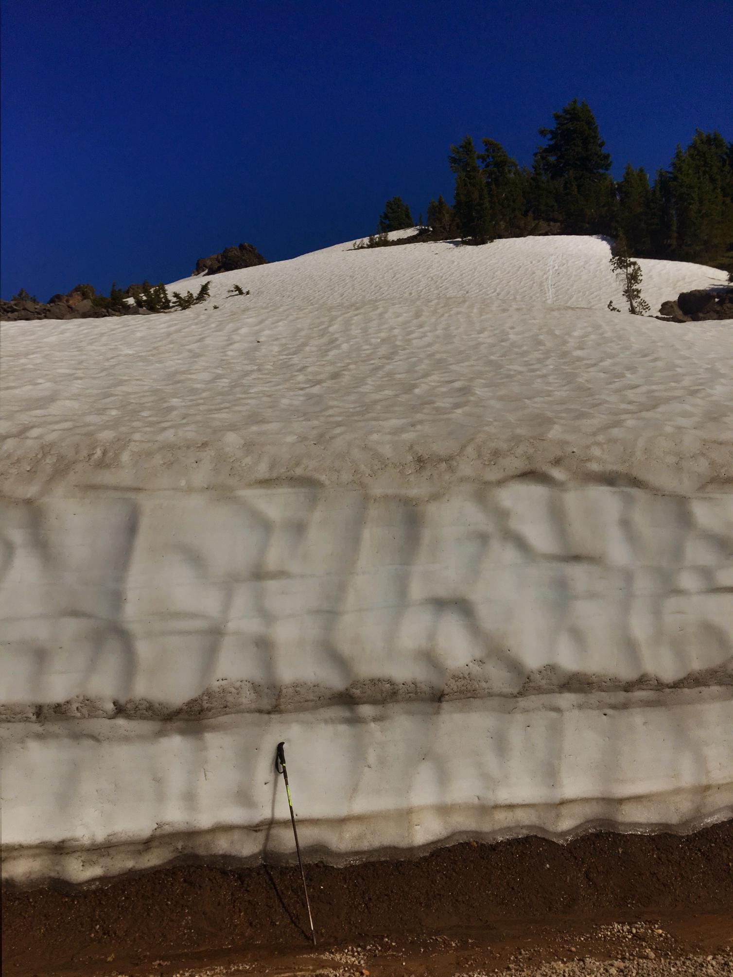
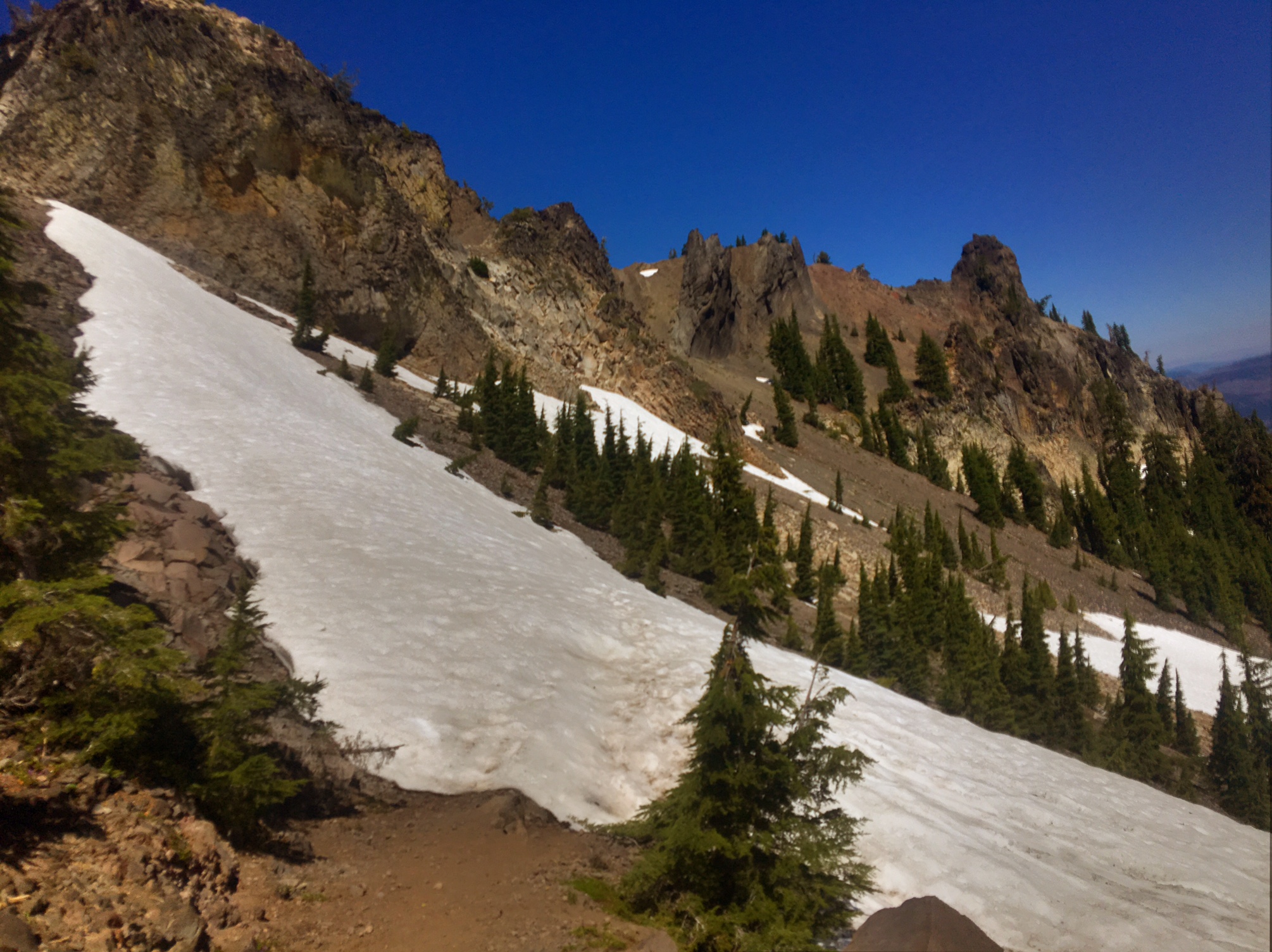
There were several large patches of snow that had to be crossed but nothing treacherous.

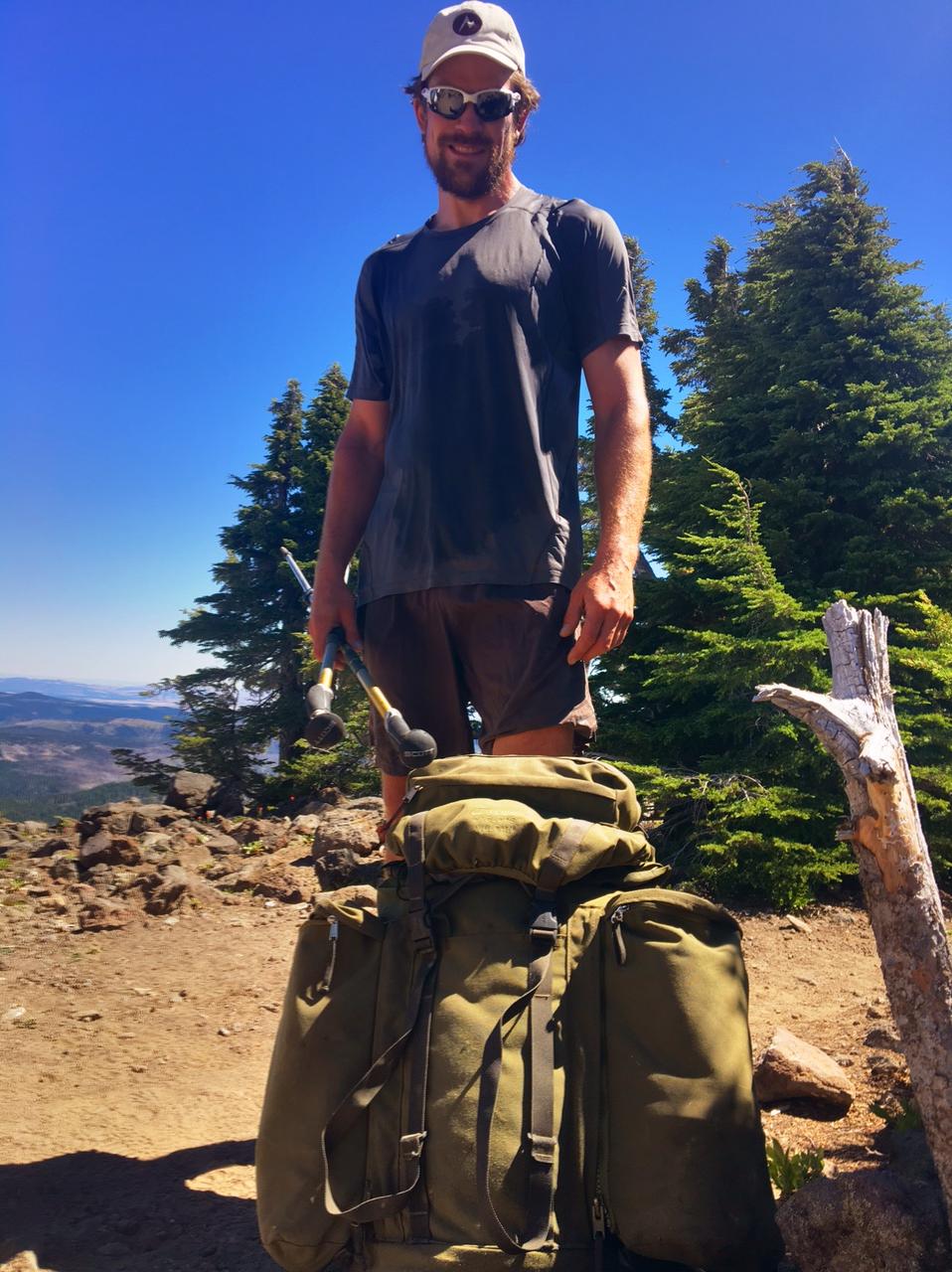
Let me formally introduce you to Monster from Germany and his 65lb pack Ozzy. As I mentioned yesterday, we briefly met on the AT last year. Monster is one of only a handful of hikers who made it all the way through the Sierra without jumping any sections. Super impressive!

A short snow traverse with Mt. Hood on the horizon. I could also see Mt Adams and Mt St. Helens but there is not enough resolution on this blog to make them out.

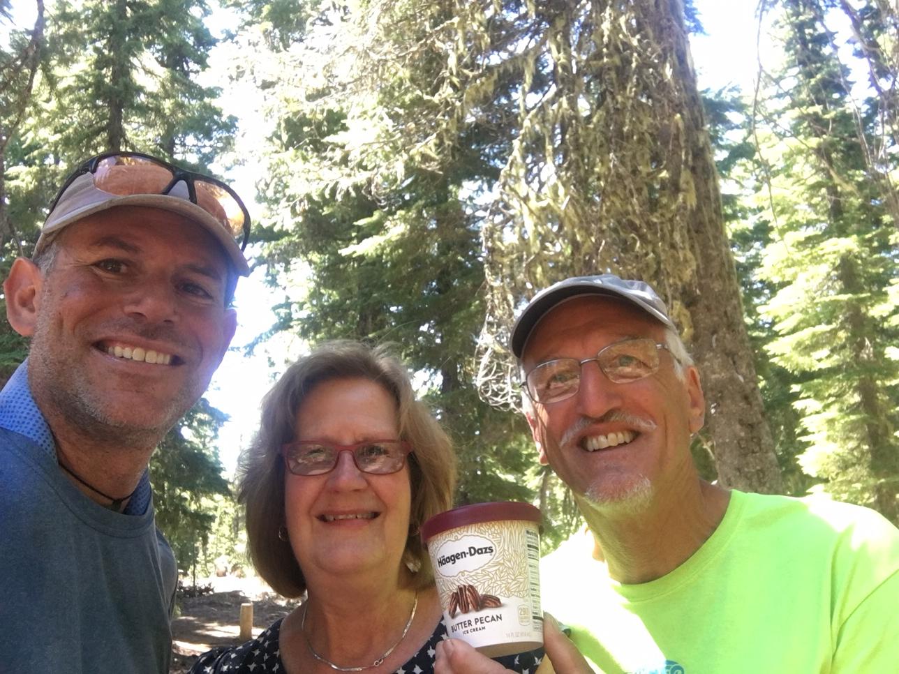
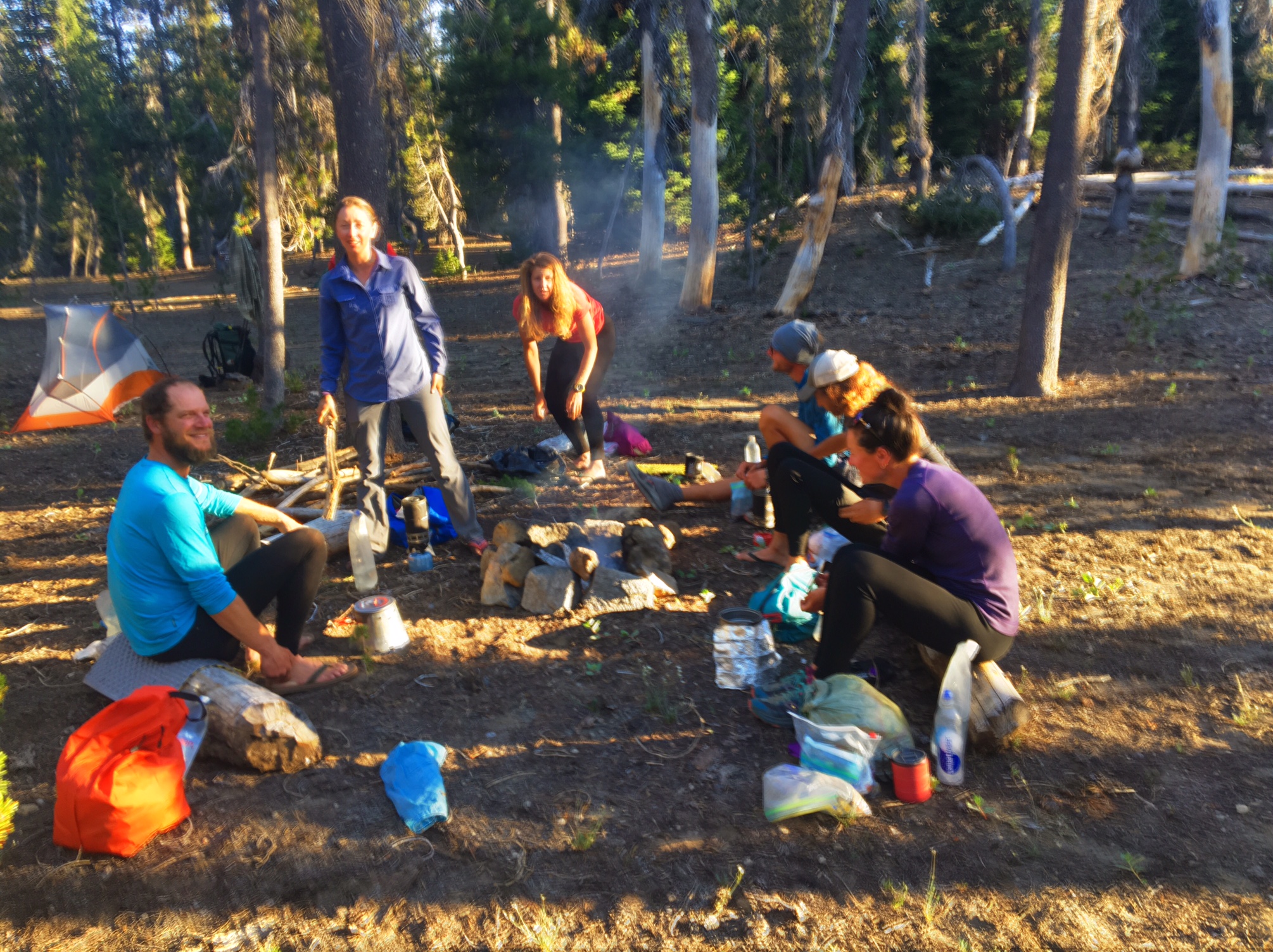
We had heard there was Trail Magic at Lake Ollalie, and we were not disappointed. It made a great late afternoon siesta.

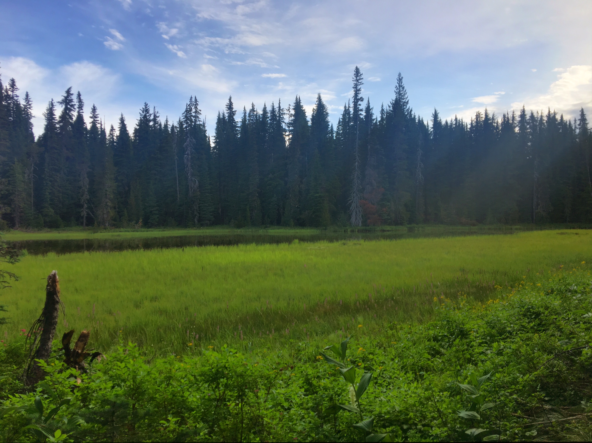
Lake Ollalie is stunning!
(Mt. Jefferson in background starting to become obscured by smoke haze).

We were visited by a USFS Ranger informing folks that the section of PCT we had just hiked through this morning would be closed starting tomorrow at 6am….just made it through in time! The closure would require 40 miles of dirt and paved roads to get around the 10 miles of PCT closure. Better to to be lucky than good sometimes!

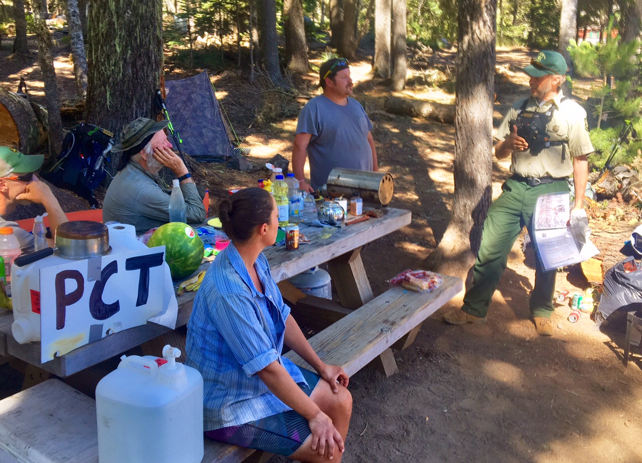
We were among quite a bit of hiker royalty. I recognized the Ranger from a blog I followed. He hiked the PCT in 2011 with his 11 year old daughter (aka Balls and Sunshine). They went on to finish the Triple Crown by the time Sunshine was 13).

The other royalty hiking through was Halfmile. Halfmile creates all the maps everyone uses while hiking the PCT and makes them available for download free of charge! He has also built a GPS app that’s free with extremely accurate data showing distances and elevations to the thousands of waypoints located on or near the trail. Thanks HalfMile !

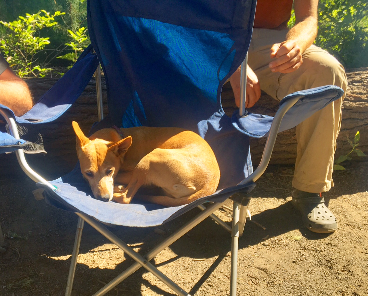
The Trail Magic mascot.

A campsite on the banks of Jude Lake was home for the night.

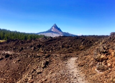
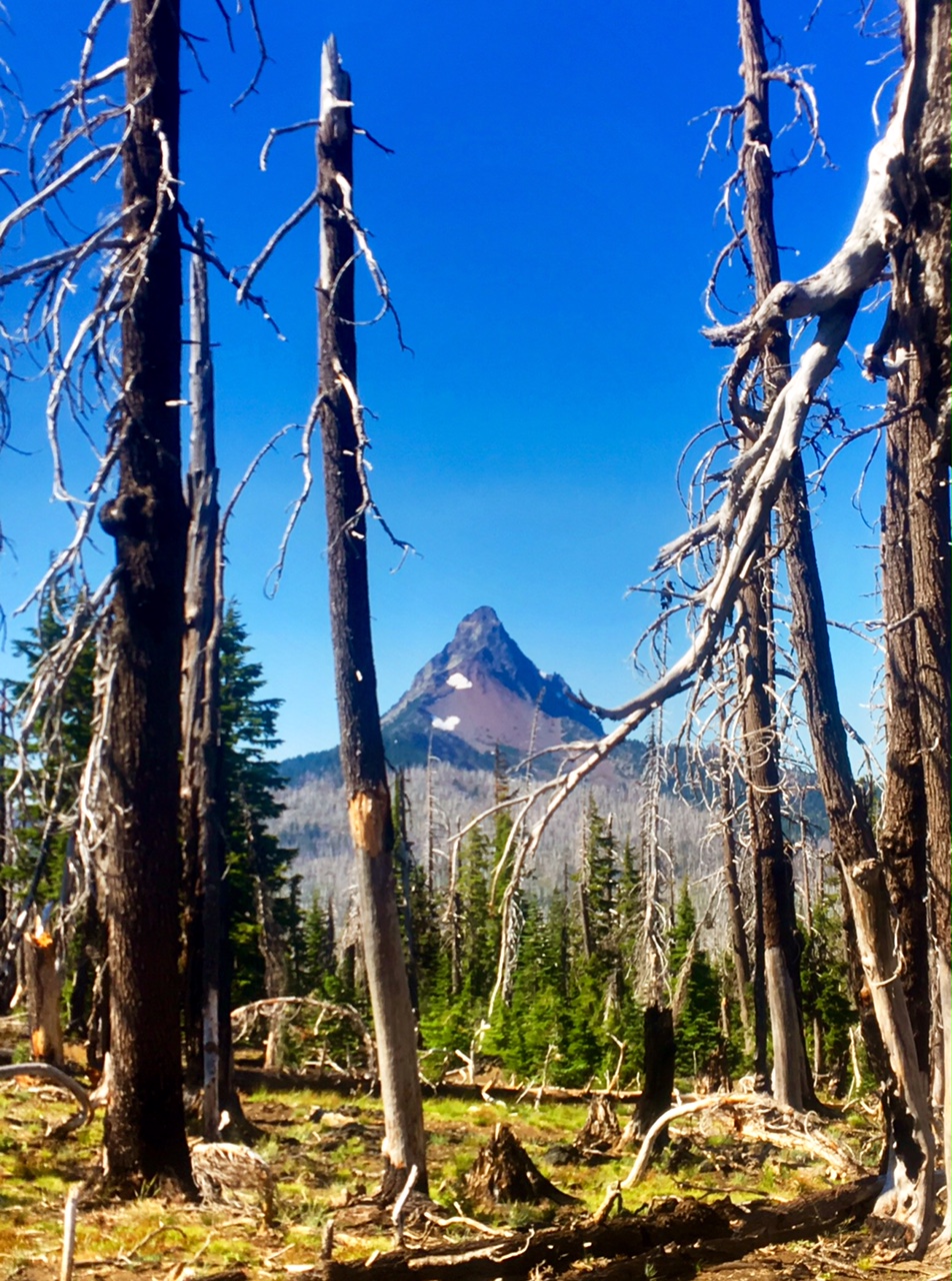
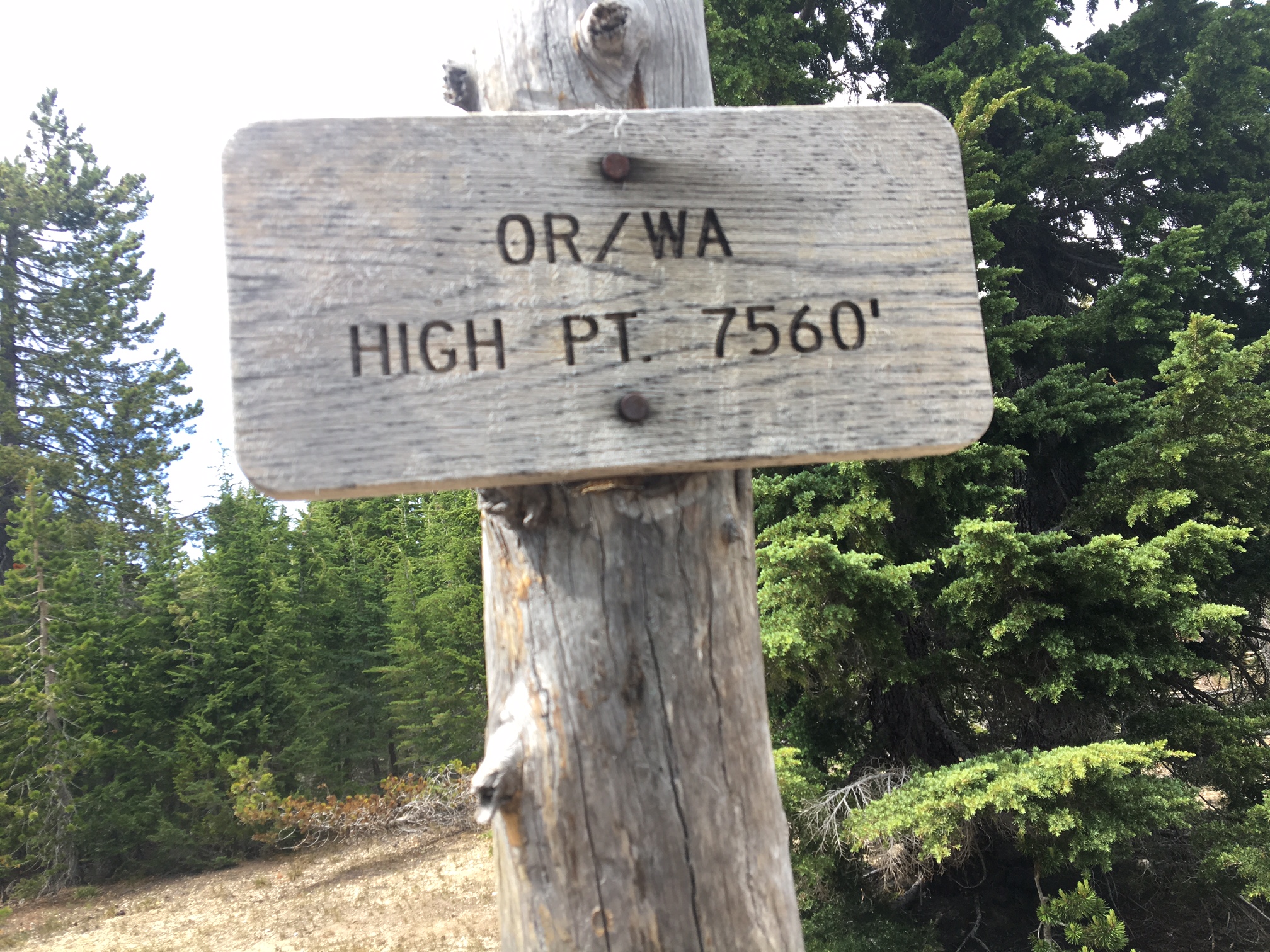
A correction to yesterday’s post…Pretty much everywhere I was referring to Mt. Washington was actually The Fingered Jack. And also, 1500 miles completed ✅

Day 64, 7/29, Near Shale Lake, M-2021, 28mi

The majority of the day was spent hiking through different burn areas (or perhaps all one?). We hiked through ghost forests as far as the eye could see sometimes. The big upside was that it made for wide open views. On the downside there wasn’t mush shade on a hot day.

Smoke on the water over Big Lake at sunrise.

Dead trees and green meadows made for an interesting juxtaposition

This is the backside of Mt Washington that we hiked around.

This is a view of Mt Jefferson with an unusual forest of live trees down below and a giant burn area beyond.

The north side of Mt. Washington.

After 15 miles without water there was a nice pond among the deadfall. It Made for a good lunch stop.

Mt. Washington fading into the distance.

Mt Jefferson getting bigger around each bend of the trail.

There were several small patches of snow to navigate through.

I bumped into Monster, from Germany, who I met on the AT last year.

Home for the night was likely buried in snow two weeks ago.

Day 63, 7/28, Big Lake Youth Camp, M-1993, 34mi

Today was a long day both in miles, time and all the different terrain and views.

I was on trail by 5:45am and got to enjoy a great sunrise.

Most of the day afforded fantastic views of big peaks.

There was a lot of snow in places but only a couple patches we needed to hike through.

In several areas of Qwest hiked through old lava flows. Not the easiest hiking underfoot.

Brilliant wildflowers !

Peaceful ponds (North Sister in background).

North Sister

Even Trail Magic…
Their son hiked the PCT last year and since they live in the area (Eugene) they like to come out to help out the hikers. They helped me out with a pint of Haagen Daz (gone in 60 seconds), as well as coke, chips and Oreos!

Mt Washington with more lava fields (5 mile section).

Selfie in the middle of the lava field with Middle Sister and North Sister on horizon.
Mt Washington again.

Home for the night was Big Lake Youth Camp…they are very Hiker friendly !

I camped next to the lake and cant wait to go to sleep!

Day 62, 7/27, Mesa Creek, M-1960, 11mi

I had a relaxing morning catching up on email and organizing gear/food. Then Neil and I ran around town doing errands ( breakfast, toothpaste, DEET, etc).

Neil’s daughter, Sylvia, showing off some of her Karate moves before soccer practice.

Neil dropped me off back at the Elk Lake trailhead around 4:30. A great 24hrs off trail…a big thanks to the whole Bodo family!

The mosquitoes were swarming but my new 100% DEET came to the rescue. Plus, the views were fantastic. This is Broken Top Mtn.

I think this is South Sister.

If it wasn’t so late in the day already I would have taken a dip in this pond.

A blissful evening of hiking with views of South Sister.

Around 8:15 I bumped into my Swiss friends, Michelle and Peter, in the area I planned on camping. Can’t pass up a campsite like this!

No sunset, but alpenglow on South Sister is even better !

Day 61, 7/26, Elk Lake/ Bend, M-1950, 15mi

It was another mosquito infested morning and I used up the last of my DEET as I left camp. Luckily, I was planning to meet an old friend (Neil) from Colorado who had moved with his family to Bend, OR last year…so I’d have all afternoon to run errands.

One of the many peaceful ponds I hiked by today.

…even an occasional meadow.

My latest gear malfunction… my two week old shoes started to tear away from the sole 😦 Hoping I can deal with this is town too.

Finally, a view ! It took a large burn area to be able to see the giant peaks we are approaching. This one might be Broken Top ?

About a mile off trail is the Elk Lake Resort. Here are my friends Steve and a Diane (met them around mile 550) from Calgary, eating copious amounts of food. Neil picked me up here a short time later and we drove into Bend 30 miles away.

There’s a great shop in town that sells used outdoor gear…and even better, they repair gear and have a cobbler on site. Luke here fixed my shoe up in two minutes.

Voila ! This should be good enough to get me to Mt Hood where Altra Shoes was kind enough to send me a warranty replacement pair.

This is why I pre-wash my socks before including them in the laundry with the rest of my clothes. Disgusting!
My lovely hosts, Neil and Sarah (their kids were away at an overnight activity with their camp)

Day 60, 7/25, Random Pond, M-1936, 34mi

The day started with a small climb out of Shelter Cove to get back on the PCT. There was a good view of Odell Lake from the Crest.

Most of the day was easy walking through the woods with the occasional pond or lake…and tons of mosquitoes!

I took a mid-morning break at this cool ski Lodge that is made available to hikers. It was nice to get away from the bugs temporarily.

This was a big burn section…the fire was from almost 20 years ago.

Showing off my disgusting legs. A combination of dirt, sweat and bug spray. (Luckily, I’m past the need for sunscreen).

Some darker clouds rolled in with thunder in the distance. Fortunately, it stayed dry.

The tenting area was limited at this random pond, but after 34 miles I was ready to call it a day. The Swiss couple that were already there were happy to share the site (he’s wearing a Bug net and n his head).

Day 59, 7/24, Shelter Cove, M-1904, 27mi

As crazy as this may sound, it was an easy and relaxing 27 miles today. I had gotten intel that the main route had quite a bit of snow. Luckily, there is an alternate route on the Old PCT called the Oregon Skyline Trail. It’s at a slightly lower elevation and passes by several lakes. On top of that it is a bit more direct route to Shelter Cove (today’s destination).

This is what stream crossing should always be like: calf high, gentle flow, and a refreshing temp on a warm day.

At mile 17 I took a long siesta at Crescent Lake. The water was a perfect swimming temp and the shade was a perfect napping temp. Surprisingly, no mosquitos here because most of the day was an all out assault. (my shoes are drying in the sun after the stream crossing).

Diamond Peak over Diamond View Lake.

Several milestones…Yesterday i passed my halfway mark…finally! And today I passed the 1400 mile mark (1900-500),

The terrain changed rather abruptly from dry and sandy with scattered Lodgepoles to this moss covered fir forrest .

For the first time I can remember I saw full cloud cover this afternoon. Apparently, this was the edge of something bigger in the area, but ultimately it was dry all day for me. (I am the blue dot).

Today’s destination was the Shelter Cove Resort. They are very friendly to hikers and it was a popular stop. Even with my two hour siesta I arrived by 5pm.

It was a great place to relax for the evening and enjoy the sunset.

Day 58, 7/23, Six Horse Jct., M-1870, 33mi

There were only two water sources over today’s 33 miles, so the plan was to make it to the 2nd source to camp. The 5:40am departure was hastier than normal due to the swarming mosquitos…they are relentless!

I think this is Diamond Lake and Diamond Peak.

This is definitely Mt. Thielsen.

I had warnings about snow on trail in this area. Luckily it was just patchy for a couple miles.

Thielsen Creek was the first water source of the day at mile 16. I had to chase it down stream a bit because the upper part was covered in snow.

My favorite part of the day.

It was a popular lunch spot.

Hiker tan (dirt) lines.
North side of Mt. Thielsen.

Supposedly it’s all down hill to Canada 🇨🇦

Miller Lake

The spur trail to the Spring was a popular camp spot tonight.

It was a 14 hour day on the trail with stops.
I’m ready for bed!

Day 57, 7/22, Crater Lake Hwy 209, M-1837, 21mi

I was really excited for today…hiking the rim of Crater Lake!

This was my 6am shot shortly after I left camp.

I had gotten some intel about some snow on the way up to the lake but it was nothing too bad and easy to navigate through.

The best part about the approach to the lake is that you don’t see anything until you are basically right there…what a view!

I spent a couple hours hanging out at the Crater Lake Lodge back porch overlooking the lake.
I found a great spot with a table and an outlet to charge batteries! My resupply box was waiting for me (thanks Katy+Todd!) I basically sat back and enjoyed the view…

with 100 of my closest friends (it is a summer weekend!). I bumped into some weekend hikers I had briefly chatted with several days ago on trail. They summited one of the neighboring Peaks and were now playing tourist.

Spectacular! The extinct volcano used to be almost 12,000′ tall and blew its top and lost almost 4000′ of mountain. The lake is ~2000′ deep in places and the water is measured to be the clearest in the world.

The rim trail had a couple sections of snow but nothing terrible.

This is a closeup of Wizard Island.

Crazy how much snow there is on the side of the road. They just opened the full road loop around the lake this weekend.

I bumped into a bunch of hikers I had met mile ~400…a trail family for a night.

The small campfire did a good job of keeping the ferocious mosquitoes in check.

Not sure if this pano shot of the lake will load, but I will give it a try.

Day 56, 7/21, Crater Lake Border, M-1813, 31mi

There has definitely been a chill in the air the last several mornings but by mid afternoon it can feel quite hot out in the open. The first 10 miles was more uninspiring trail through the pines with mosquitos and lots of blow downs… It’s kind of an obstacle course.

By mid morning I finally had some views 🙂

Then it turned into a giant burn area…with wildflowers!

No, that’s not Mt. Shasta…it’s Mt McCloughlan (~9000′).

There was one notable climb today…Devils Peak. I had intel so I knew to expect snow on the steep north facing side.

It wasn’t too bad actually. If I there had been other folks in the vicinity I probably would have glissaded down the slope. But with the melting snow the last thing I wanted was to get the top of a pine tree up the pooper and wallow in the snow waiting for help. Instead, I descended some soft scree just to left of this pic. Discretion is the better part of Valor !

By early evening I had arrived at the border of Crater Lake NP.

Not too worse for the wear after a 31mi day.

I had a great pine needle campsite all to myself. Definitely a tent night with all the mosquitos.

I wasn’t patient enough to wait around for the whole sunset…I was anxious to get in my sleeping bag.