
This was the view at my 5:15am departure.
Unfortunately, all I could think of was how was the dread of crossing Tyndall creek in 2 miles, a rather large fast moving creek 5 miles before the 13,000′ Forrester Pass.

After wandering a 1/2 mile upstream I couldn’t have been happier to find this isthmus of snow to get me across safely and dry!

Can you figure out how we will get over the 13,000′ Forrester Pass headwall? Answer below.
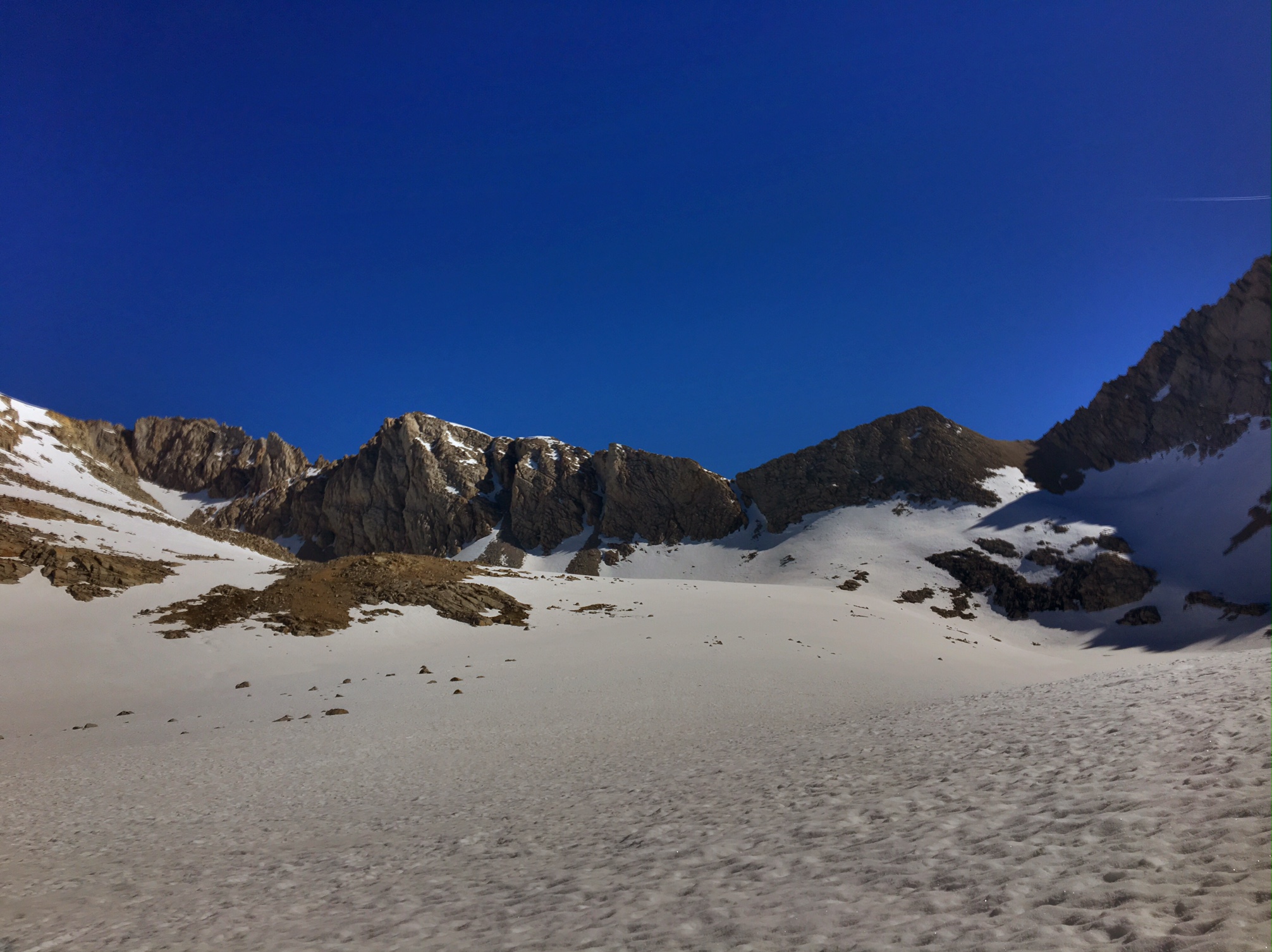
Here’s a clue…

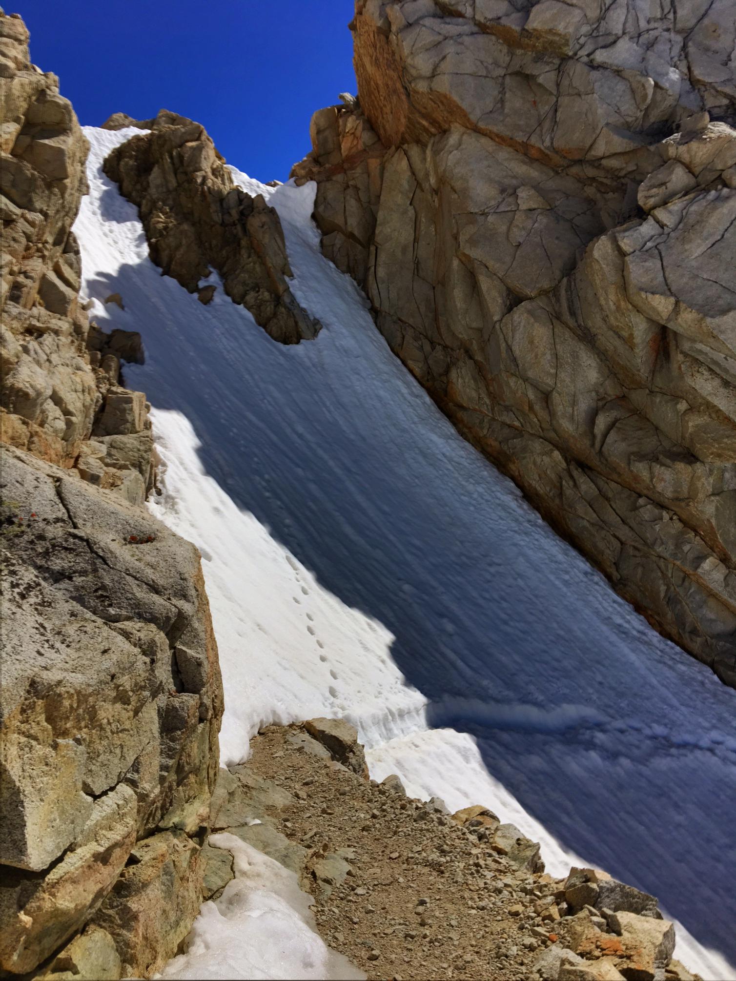
And another… (at least someone had cut in a footpath through the snow!)
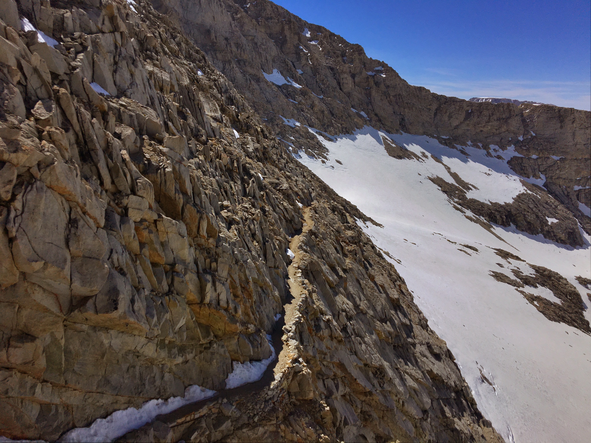
This was the approach (after climbing the vertical snowfield). The trail here is a true feat of engineering.
Made it to the highest point on the PCT 🙂

The view from where I came up from.
The view on the way down.

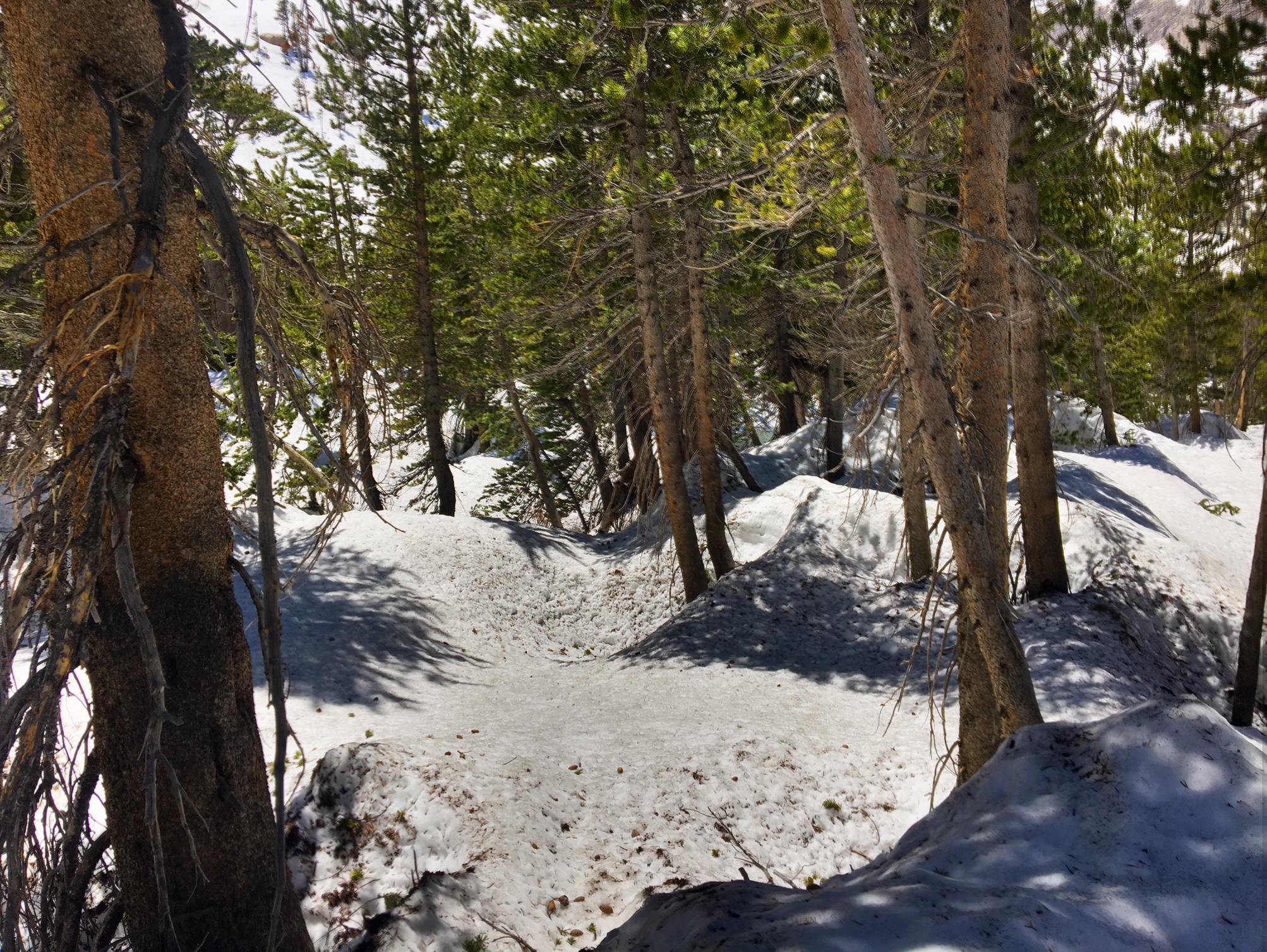
This is what navigating through the woods looks like…

..or this.
Luckily GPS helps immensely but it doesn’t account for the giant berms of snow or trees piled up like pick-up-sticks from avalanches.
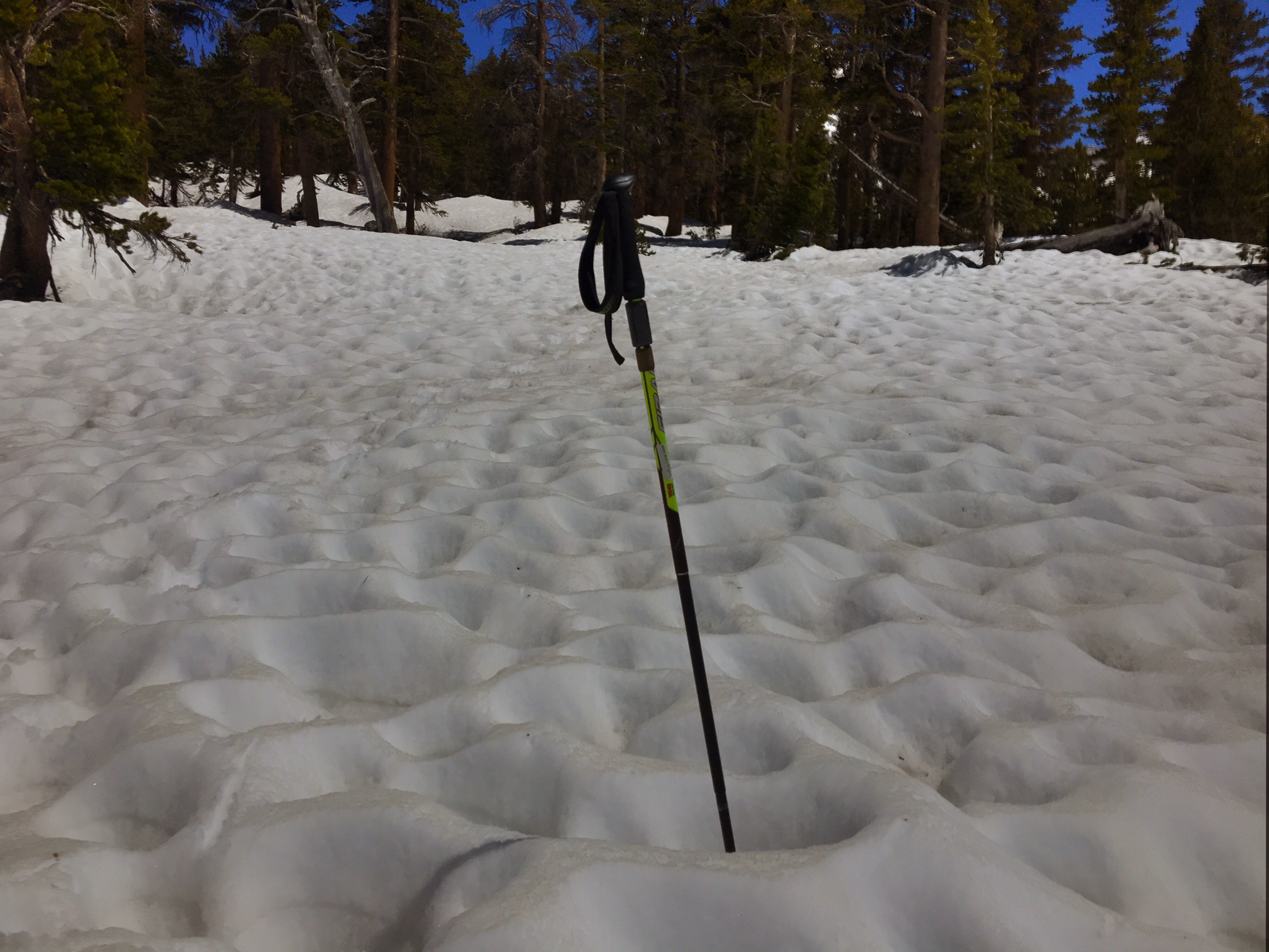
Then there’s postholing up to your crotch (no pic), or navigating fields of sun cups (these are 5-10″ deep).
The end of a long day got me to Vidette Meadow in Kings Canyon NP. The first dry land I’d seen all day…although most of it was mushy ground.

I found one good dry spot at the receding snow line between creeklets and some more mush. And surprisingly, there were no mosquitos.

Forrester Pass

A full day on trail and I saw zero people until 1/4 mile from camp…kind of crazy!

Holy moly, no longer a walk in the park! Careful on those ice/snow bridges!
LikeLike
Incredible Day
My favorite so far.
LikeLike