Day 3, 4/8: Mile 31.7, Neels Gap (15mi)

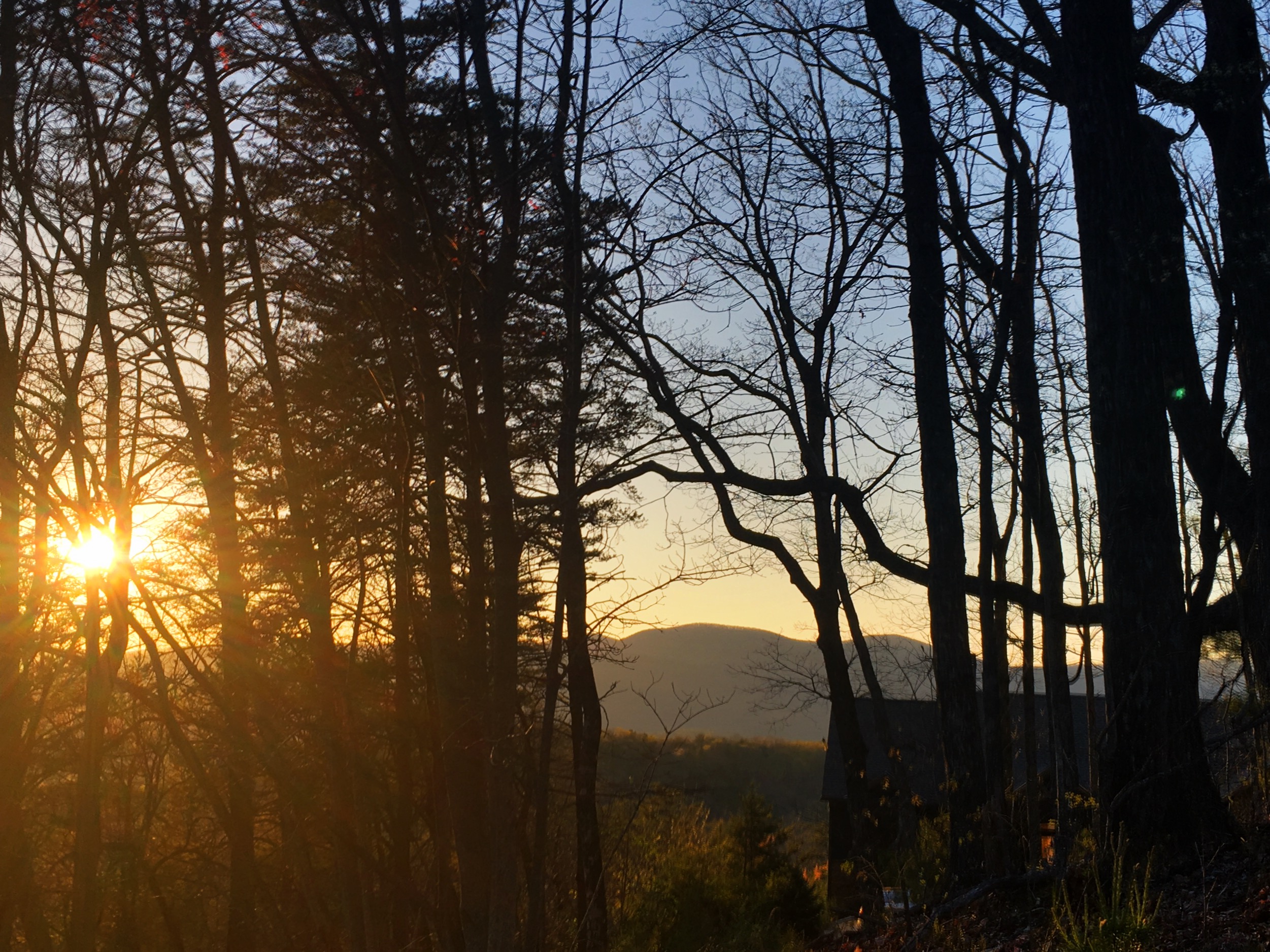
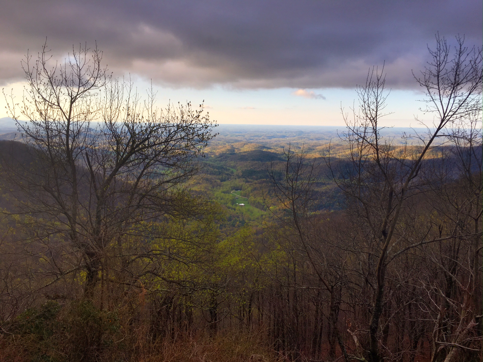
It was a cold start this morning in the upper 30’s, but the skies were clear and there were some good views.

I hiked most of the day again with Miles from BC. I’m trying to convince him to go with the trail name “Miles from Nowhere” or “Miles to Go”
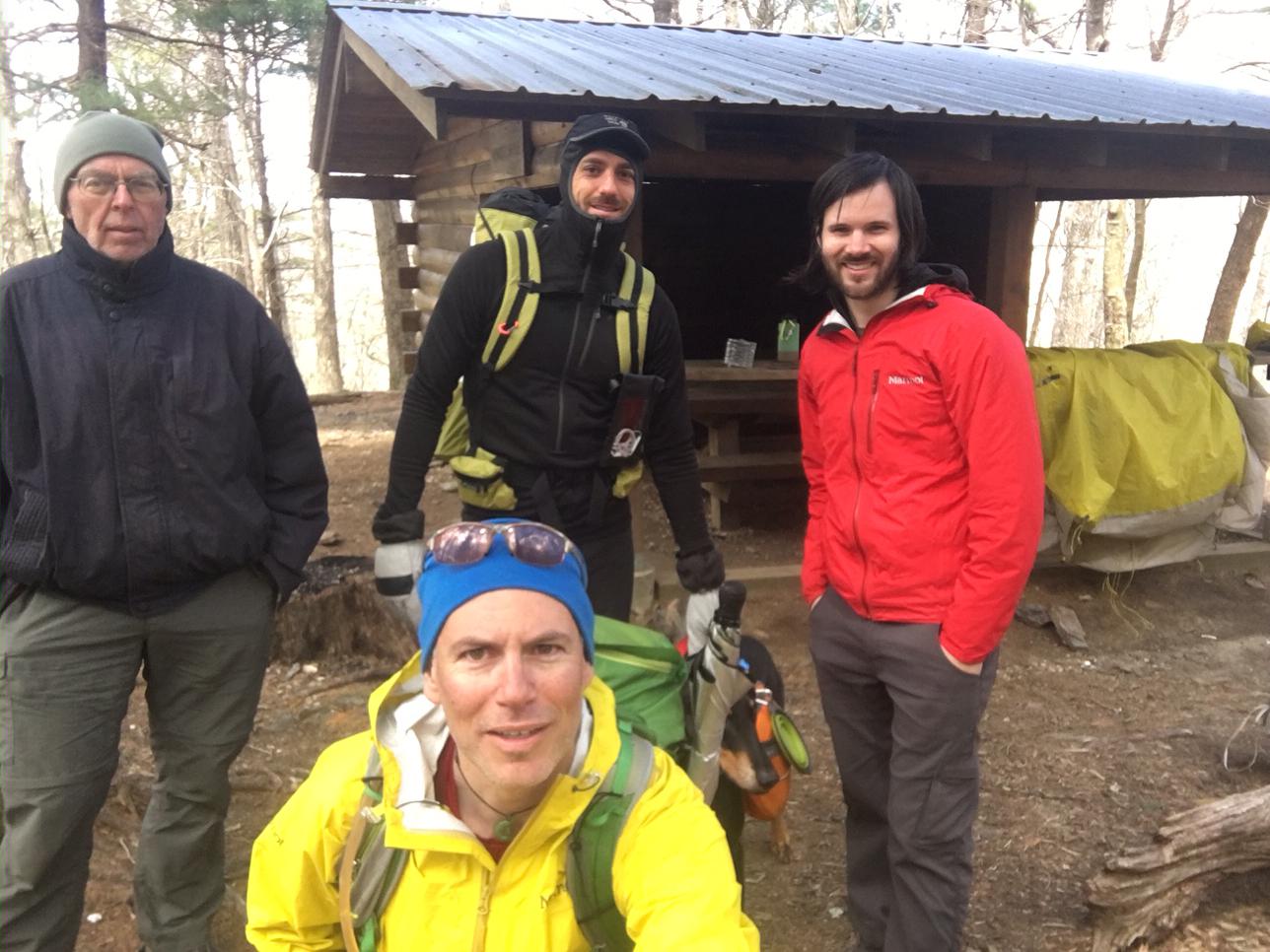
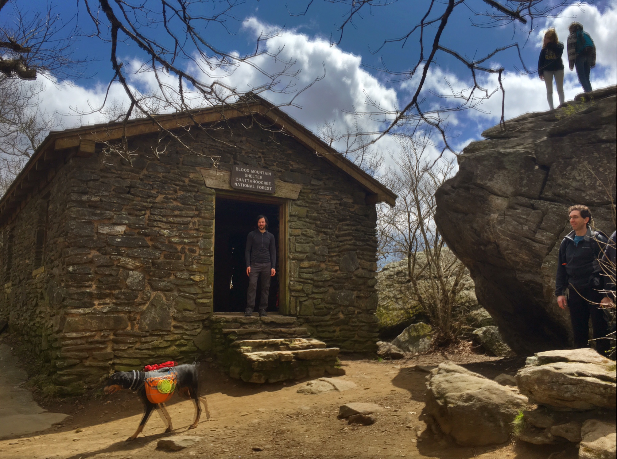
We met another guy named Chris hiking with his dog Greta and stopped at a shelter for lunch where we ate with Pappa Crusty…you can guess who’s who.

The big climb of the day was to the highest point in Georgia…Blood Mtn (~4500′). There was this really cool CCC shelter at the top.

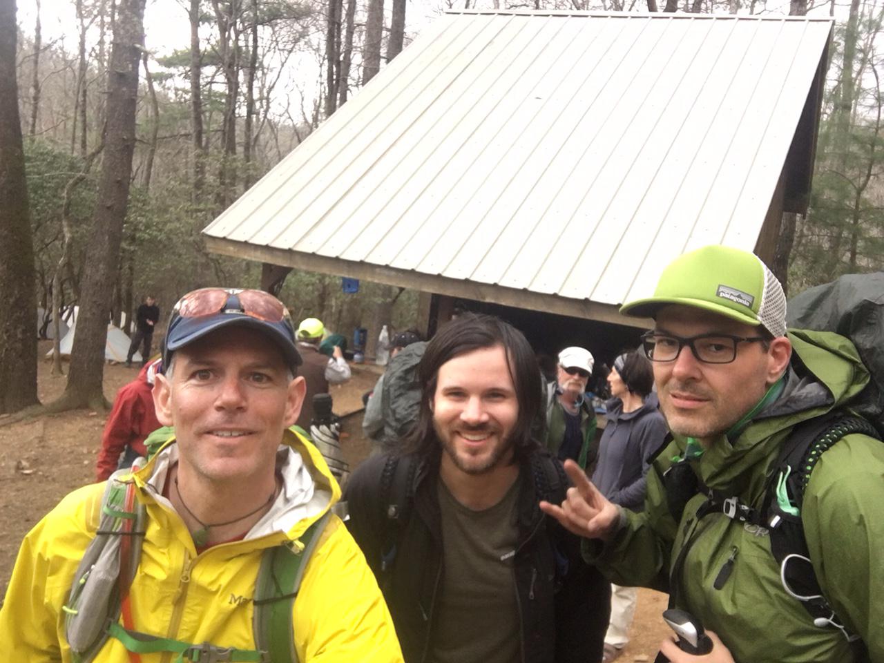
This is the awesome patio/overlook at Neels Gap. There is an outfitter store behind us that sells gear and hiker food and sends home tons (literally) of unwanted gear since so many people over pack.

This is the hiker shoe tree out front…brilliant!

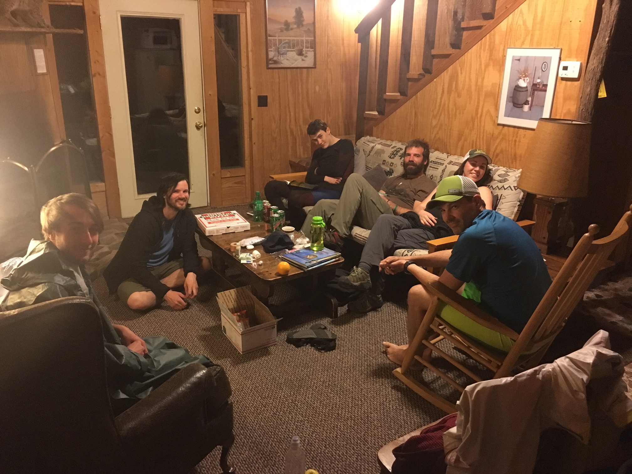
Some of the folks I met decided they wanted to be more civilized tonight and rented a cabin. I’m camping since I’m planning to resupply in town in two days, but o hung out with them for a bit tonight.

Day, 2, 4/7: Mile 17, Gooch Gap (14.5 miles)

It absolutely poured and thundered with big strikes of lightning through the night. Luckily, it cleared up by the time I woke up ~6am. It was Quite brisk in the upper 30’s. I headed out around 7:30 with a nice guy named Miles from Victoria, BC. Here we are hiking through some rhododendron that will be stunning when they bloom in several weeks.

Water seems to be a natural congregating point for hikers…much like cattle. The sun was out and things warmed into the upper 60’s. This was great place to soak the feet about 11 miles into the day.

The Gooch Mtn. shelter was today’s planned destination but as you can see, it was a tent city by 3pm so I decided to hangout for a bit then hike another 1-2 miles in the evening and camp along the way.

Miles and another hiker, Tony from VT joined me.

We found a great spot and met Odie who makes the Hiker Yearbook (old school) and hung out by a fire next to his school bus camper. Far more relaxing then the tent city.

A great day that ended with some late evening rain driving us into our tents around Hiker Midnight (8:30).

Trail Mile: 17.4

Day 1, 4/6: Mile 2.8, Stover Crk (11.6 mi)

The hardest part of a difficult journey is taking  the first step…and that step was taken today. The Lodge shuttle drop us off at Amicalola Falls State Park on a cool 40 degree morning around 9:15.

After registering at the visitor center (#1335 for the season…plus a similar amount who start 9 miles ahead near the top of Springer Mtn), photos were taken at the famous approach trail arch and off I went.

There are a set of ~630 steps about a mile in that help you reach the top of the falls.

The official start of the AT is about 9 miles along at the top of Springer Mtn, identified by the famous hiker plaques and the first official White Blaze that marks the trail all the way to Mt Katahdin in Maine.

There was a great view from the top of Springer. Leaves haven’t quite budded at this elevation yet.

Home for the night was the Stover Creek shelter (a fancy two story variety). With a motley crew of thru hikers and section hikers from all over the country and world (a couple of Germans)

Black bears are fairy active in the area so shelter also provides cables to hang your food from (in background…FYI, not my tent).

A successful first day without too much undue stress on the body…just some tightness in my Achilles.

Day 0, The Storm Before the Calm

Everyone has been asking me if I have all my gear and supplies ready for for my departure, but that was the easy part. It’s a lot more work getting ready to put one’s life on hold for 4-5 months..making sure bills get paid, dealing with loose ends for work, saying goodbye to friends and family. I was worn out by the time I got on the plane to Atlanta this AM. Starting the hike will be much less hectic. Thus, the Storm before the Calm.

It was a quick 2hr 15min flight, the pack went in the overhead bin, jumped on the MARTA (Atlanta train) to the end of the line where the Hiker Hostel shuttle was waiting for me. Then a 1.5 hour drive into the mountains to their cozy lodge near Amicalola Falls State Park and Springer Mtn., the official start of the AT.

image There were about 20 other hikers here either starting tomorrow or a couple days into their hike (we are near a rd crossing 20 miles from start). I relaxed and wandered around the property enjoying the late sunset (8:00) over the Appalachians. image
Looks like nice weather for tomorrow’s start 🙂

No Joke !

Spring in Appalachia is no joke!
Nothing like following a cold rainy day with a 18 degree night. It’s the occasional night like this that worries me with my 30 degree sleeping bag. Perhaps I will bring my sleeping bag liner for the first couple weeks and test its claim of adding 20 degrees of warmth !

In the first 2.5 weeks the AT climbs over the highest point East of the Rockies, Clingmans Dome (~6700′).
About 75 miles of trail through the Smokies hovers around 5000′ or higher which means serious mountain weather on the East Coast.

This is a link to the weather forecast at 5000′ in the Smokies: http://forecast.weather.gov/MapClick.php?lat=35.5629&lon=-83.4985#.VwJHYkVOKnM

This is a cool link to weather forecasts all over the AT by state…then you can choose a specific location with the elevation in parentheses: http://www.atweather.org/forecast?myState=GA&myShelter=10

Test Drive

Decided I should test drive my Zpacks Hexamid tent overnight in the backyard. I chose a freezing cold night (22 degrees) to see how it handles condensation and also see how well my 30 degree down bag  worked with the Sea to Summit Thermolite sleeping bag liner.


I also tested out a Mylar bag inside the sleeping bag to see how much  that helped out the warmth.

Prognosis, minor frost build up on inside of tent (condensation), Thermolite was great , Mylar burrito…gets a bit clammy and obviously, crinkly. The only thing chilly were my feet, probably just need better insulation from the ground.


The Thermolite weighs in at just over 9 oz and I’d have to ship it home when nigh time temps warms up. The Mylar burrito ways 2.5oz and I would just throw it out when it wasn’t needed anymore.

There will likely only be a couple of nights below freezing at the beginning (The Smokies), so I’m leaning toward the disposable Mylar. I’ll make the call after I check the 10-day forecast right before my departure.


What’s in a (Trail) Name?

One of the more interesting  rituals of long distance hiking, and especially thru-hikes, is the use of Trail Names. There are many reasons this has become accepted practice from the basic idea of taking on a new identity to the concept of social leveling…plus it’s just fun! If I introduce myself as “Dean” to someone I meet on the trail the other person has really learned nothing about me…but if I introduce myself as Bug Juice there is an instant understanding, even if they don’t know the backstory of the name. Speaking of which…where exactly did the name Bug Juice come from?

What is that Red stuff in the tube?

Continue reading

March 20, Don’t Be Fooled

Many people out West where I live are naive to the brutal nature of trails on the East Coast. Switchbacks were not in the trail builders lexicon when they built the A.T. Many trails out west were built with horse and stock animals in mind making the grades gentler and the overall trail conditions more accommodating underfoot The trails I have often hiked back East in the Adirondacks or the Whites go straight up the mountain regardless of the terrain or angle.

To give this some perspective, the Pacific Crest Trail is ~20% longer (2675 miles) yet the AT has 60% more elevation gain. The Continental Divide Trail is over 40% longer (~3100 miles) but the AT gains almost 30% more elevation.  Here is a link to a good website by the Appalachian Mountain Club with some of these stats: AMC

Continue reading