
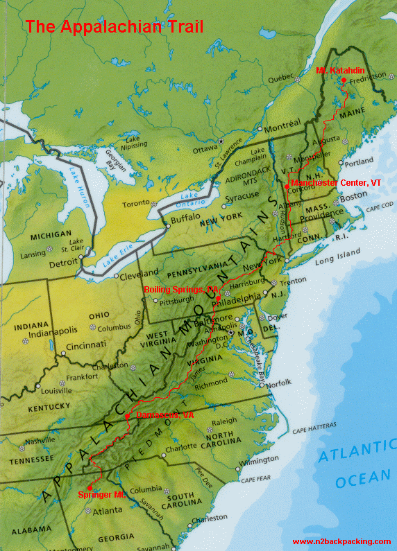
The total length of the AT changes a bit every year as the trail is improved or re-routed. The latest number I’ve read is a total distance of 2187 miles from Springer Mtn., Georgia to Mt. Katadhin, Maine…something like 5 million steps. I will definitely admit, this map is a bit intimidating!
Here is a link to an interactive map from the ATC website (not sure why some of the elevations are in meters?)
