Day 109, 9/15, Virginia Lake, M-892, 24mi

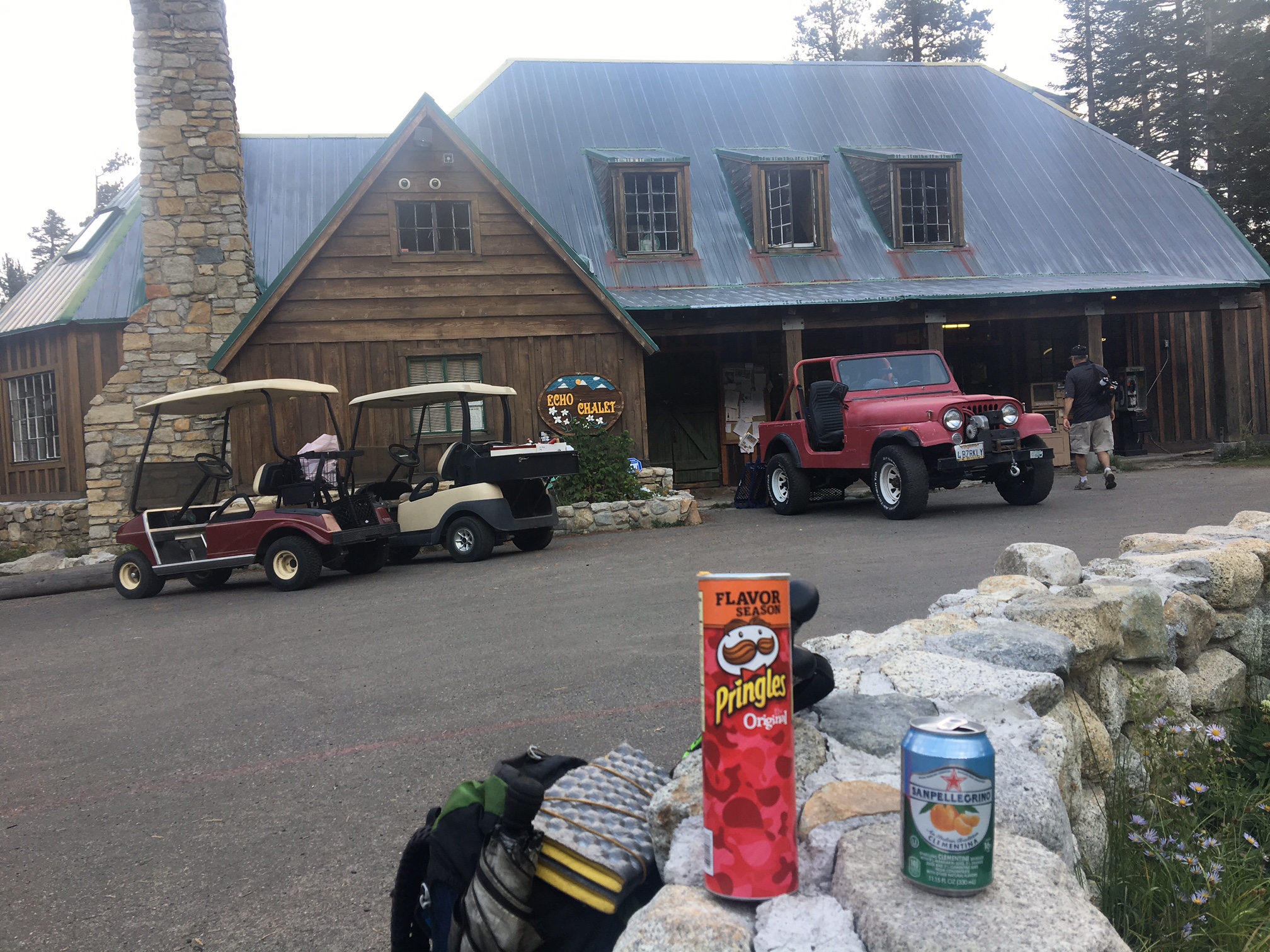
Somehow, I got a hole in my mattress the other day (while drying it out ?) so I didn’t get the best nights sleep. Fortunately, I was camped on some soft pine needles and it wasn’t too terribly cold (the mattress insulates too). I used my sit-pad under my hips and managed OK. Today I was able to find the hole when I stopped at Reds Meadow Resort and hopefully the patch works.
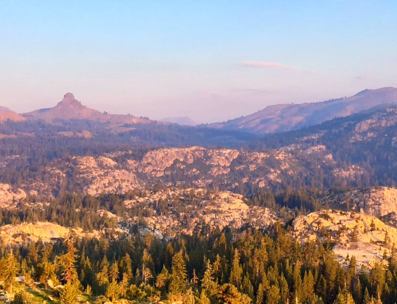
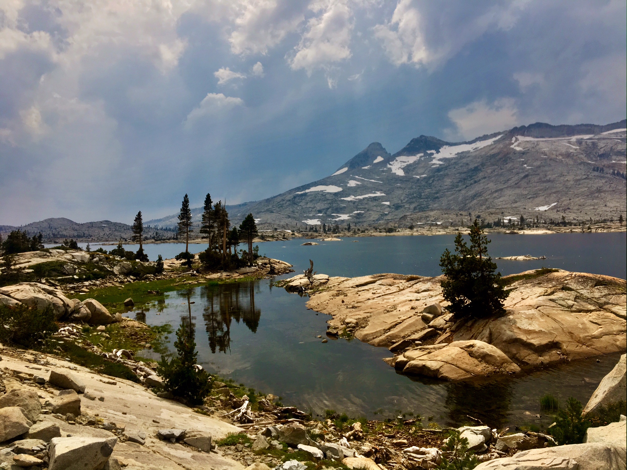
Smoke on the water.

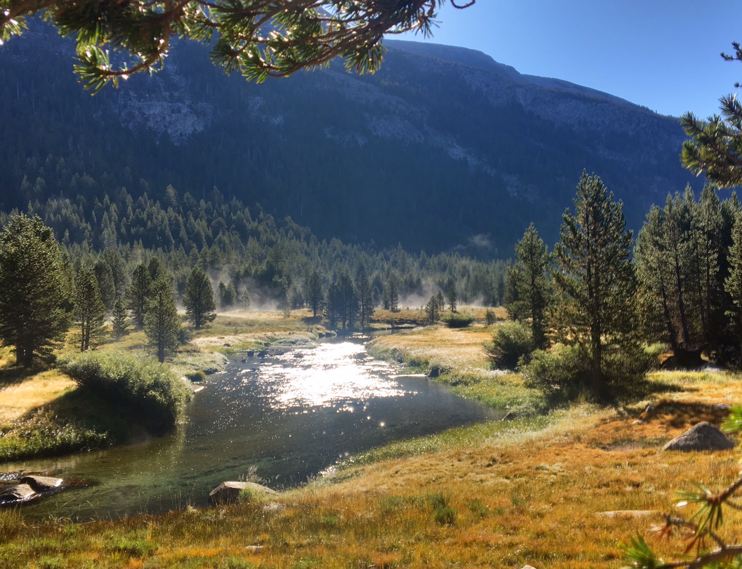
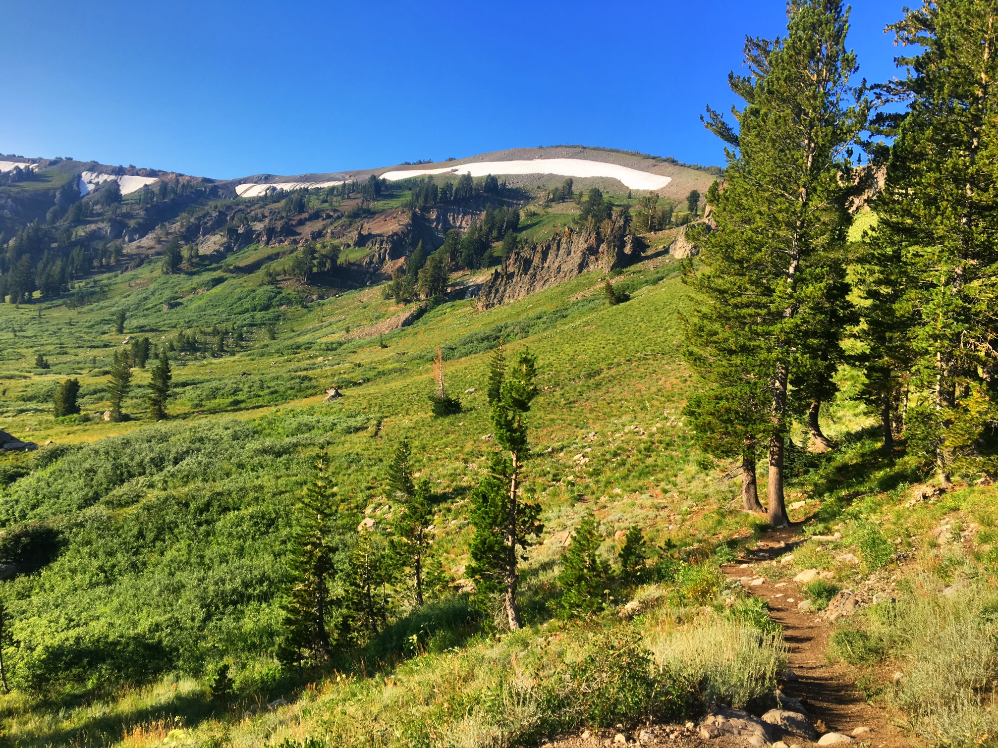
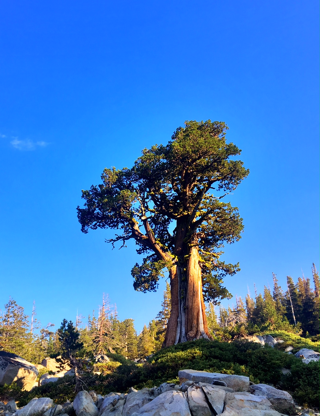
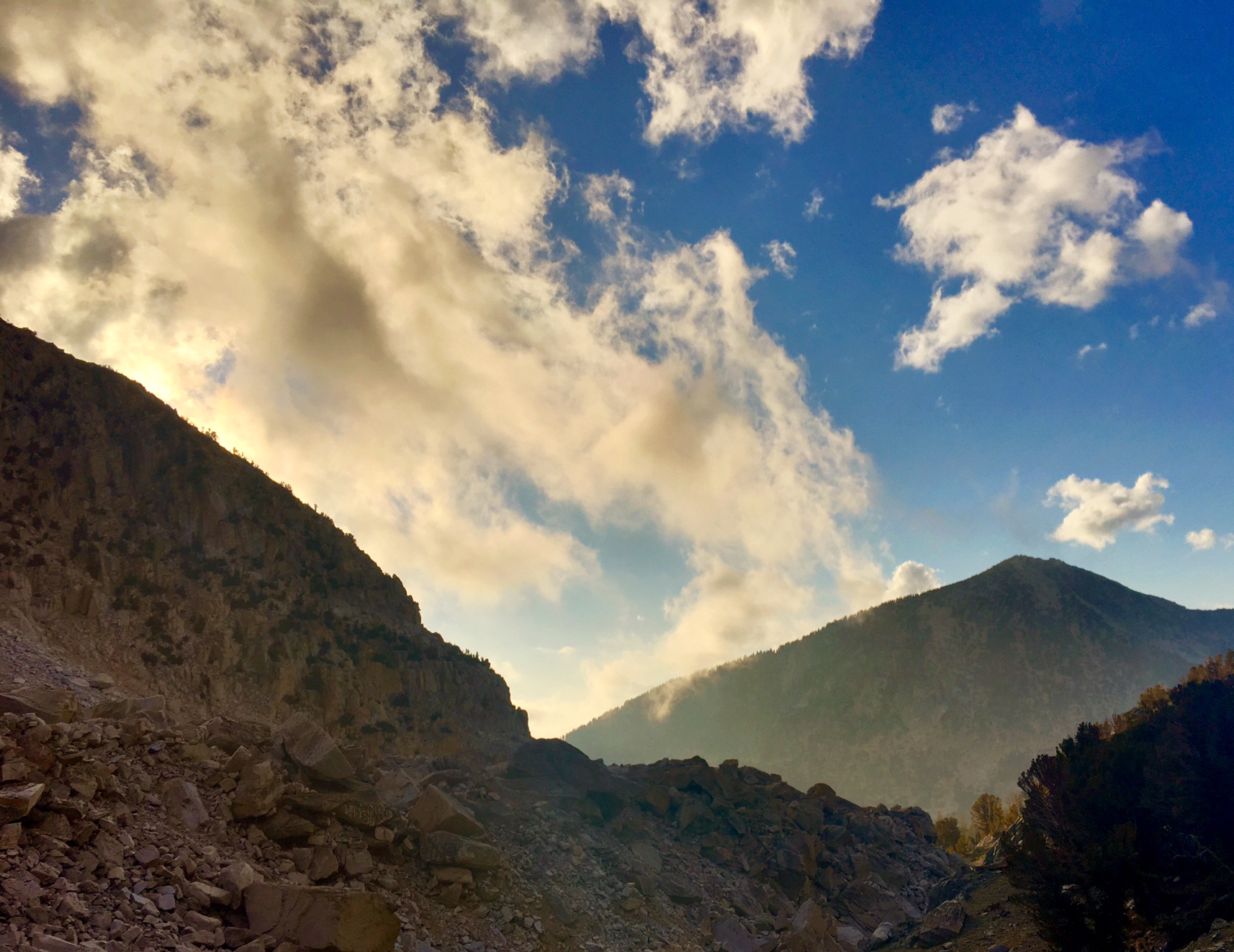
Finally, some direct sunlight to warm us up this morning.

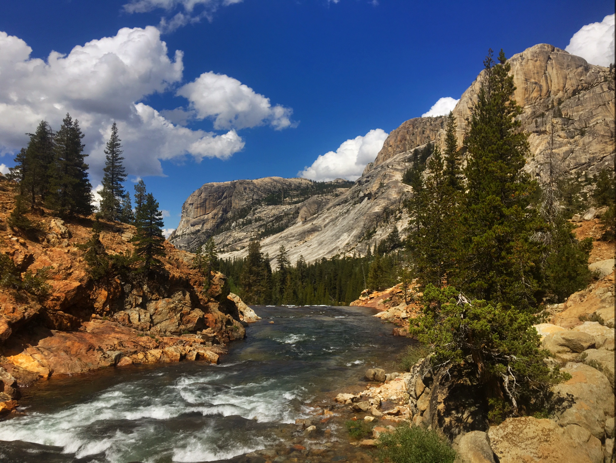
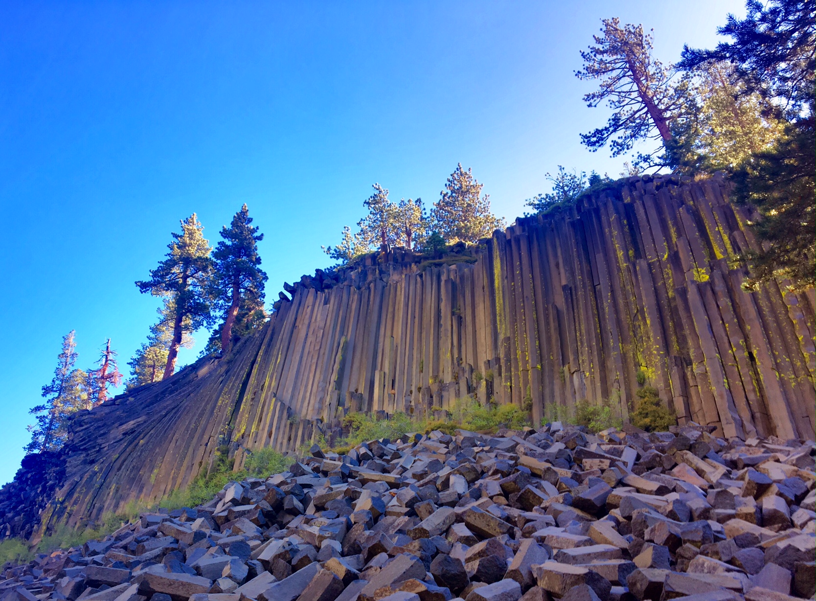
A short side trail through Devils Postpile National Monument.

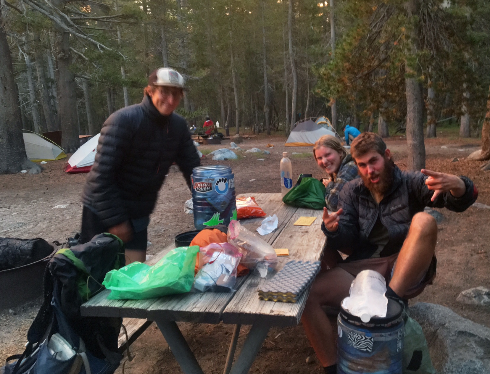
I took a 3-hour break at Reds Meadow to rest, eat, charge batteries, and fix my mattress.

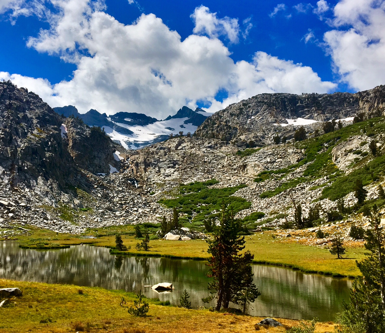
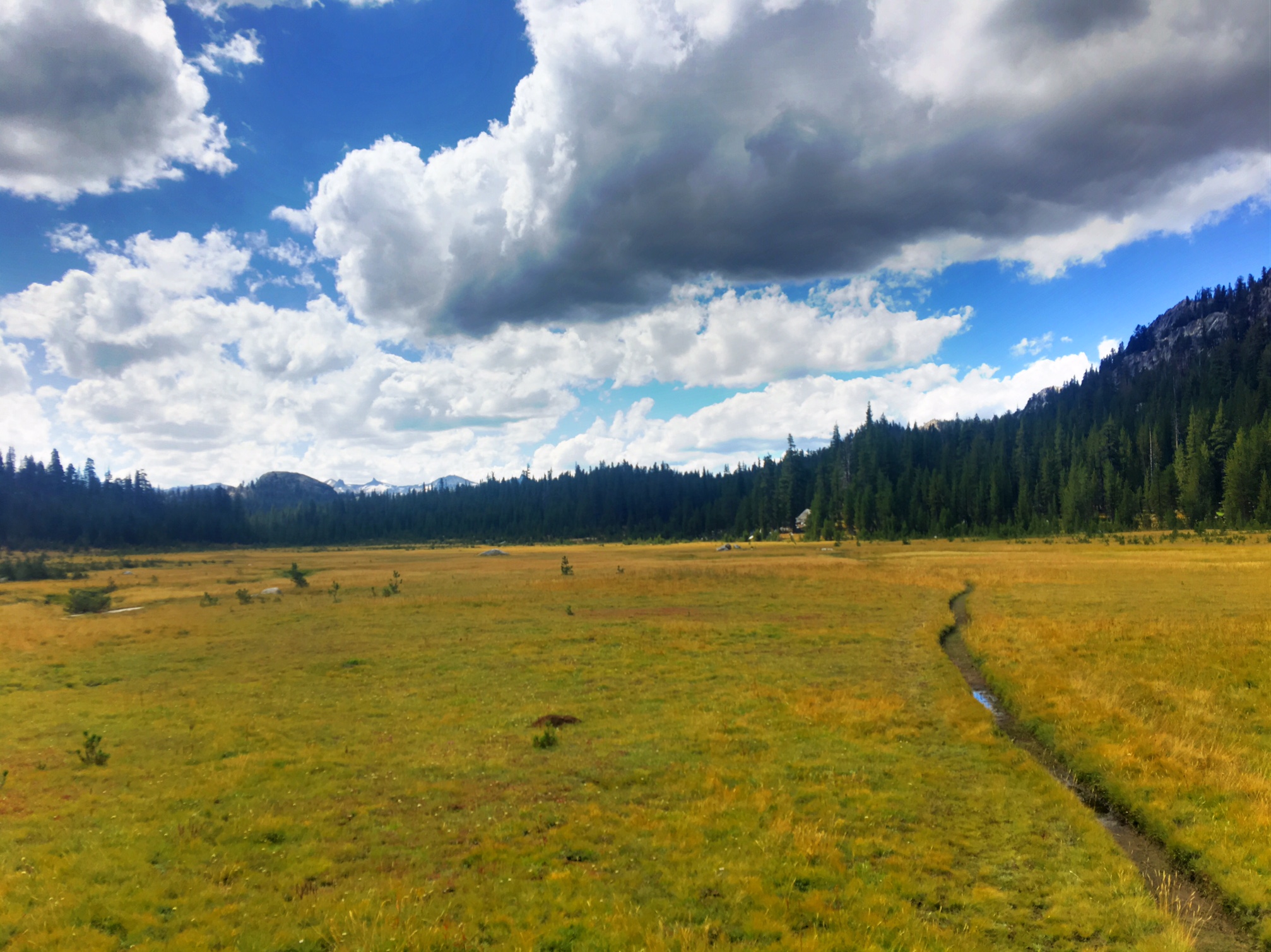
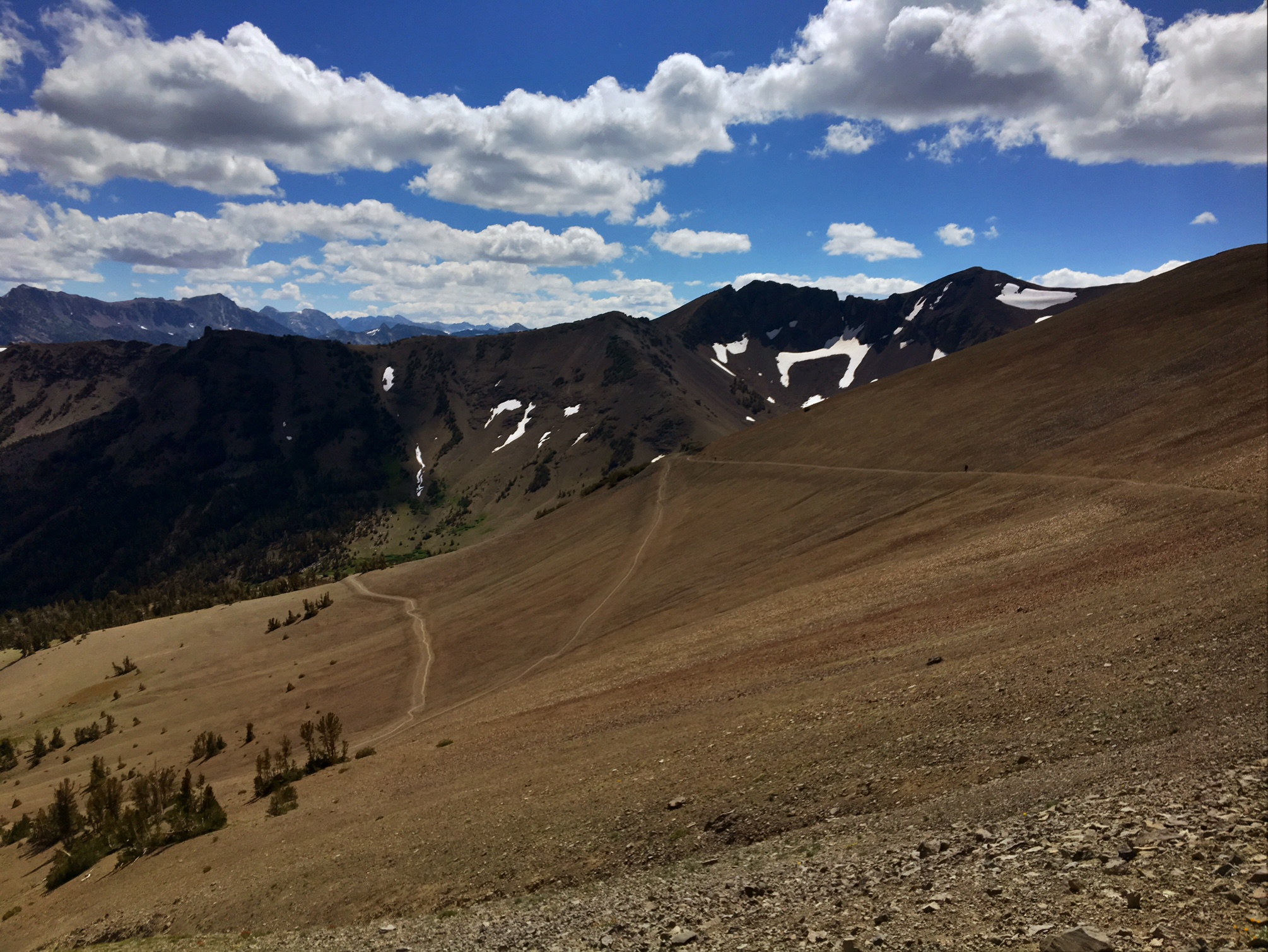
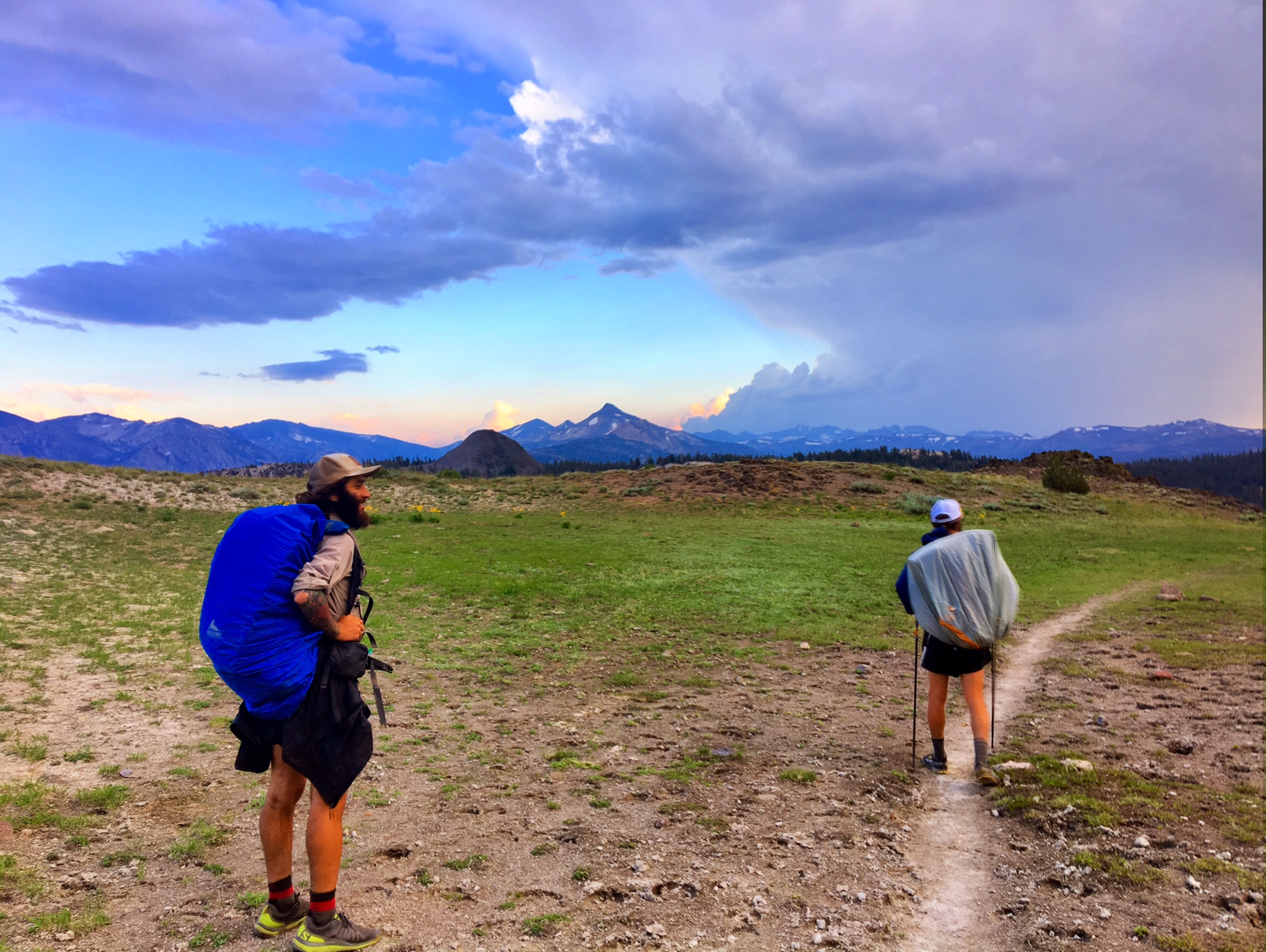
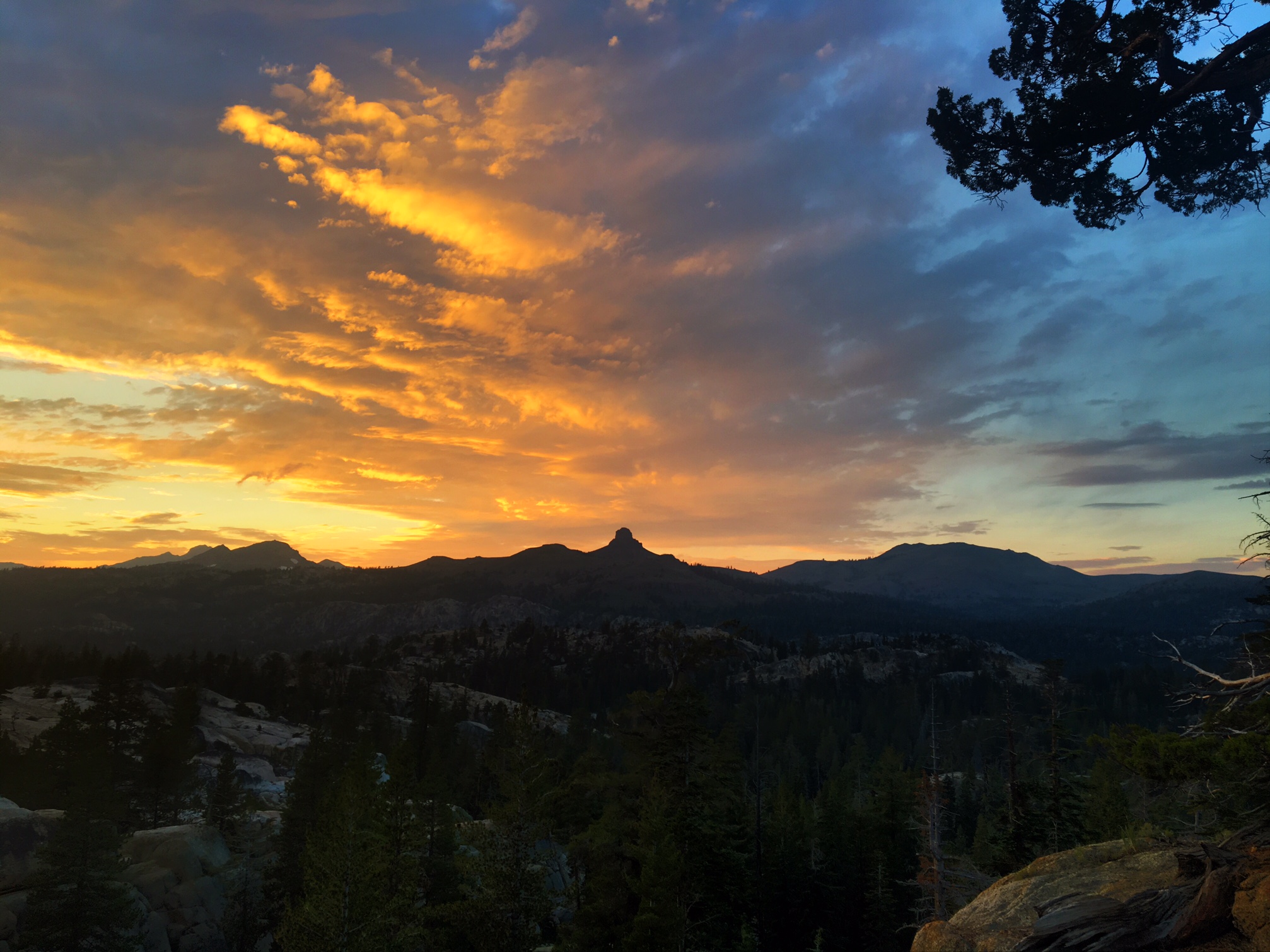
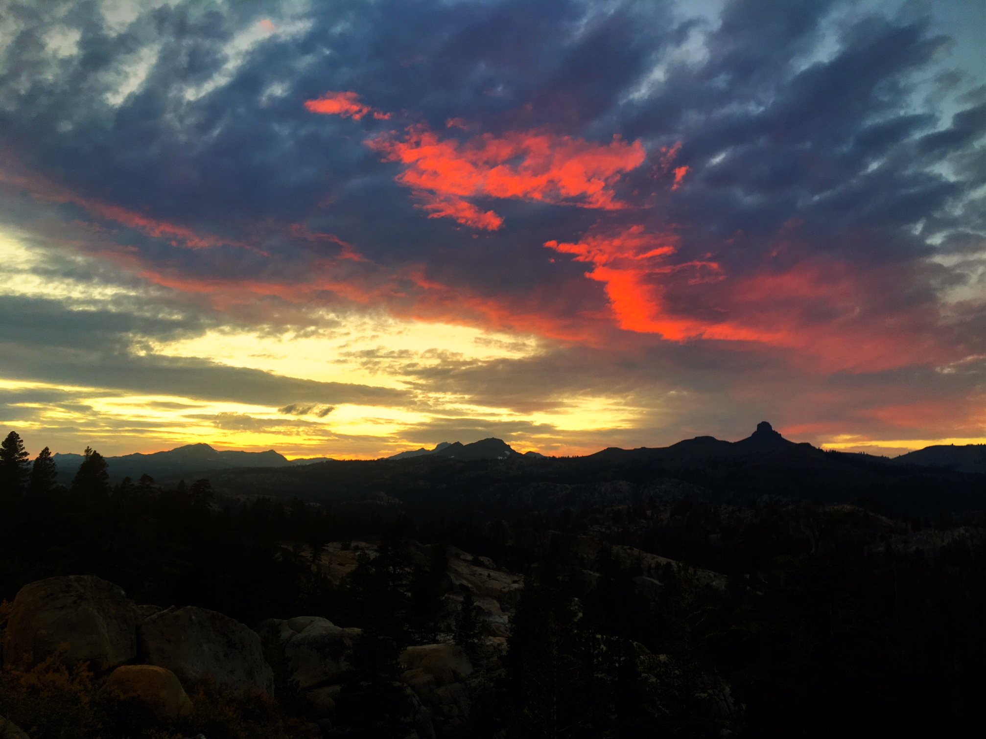
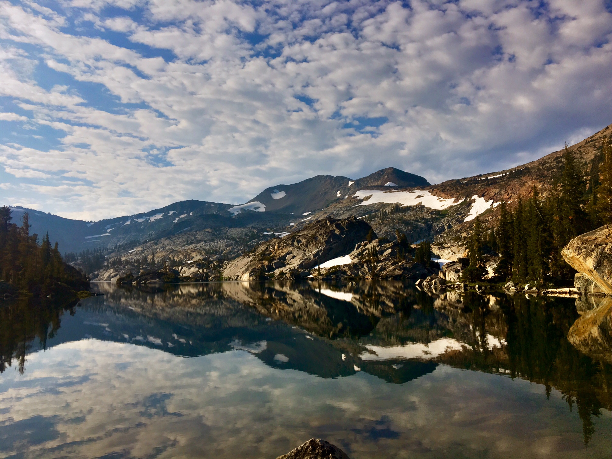
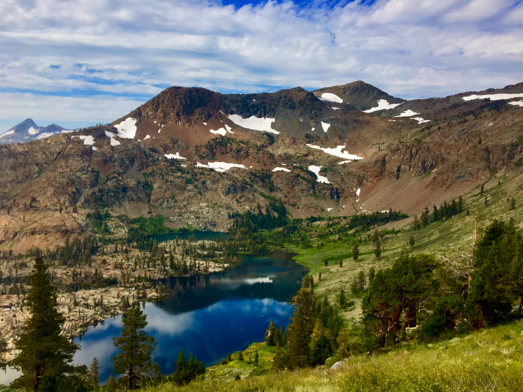
Many cool cloud formations, and thankfully, no rain.

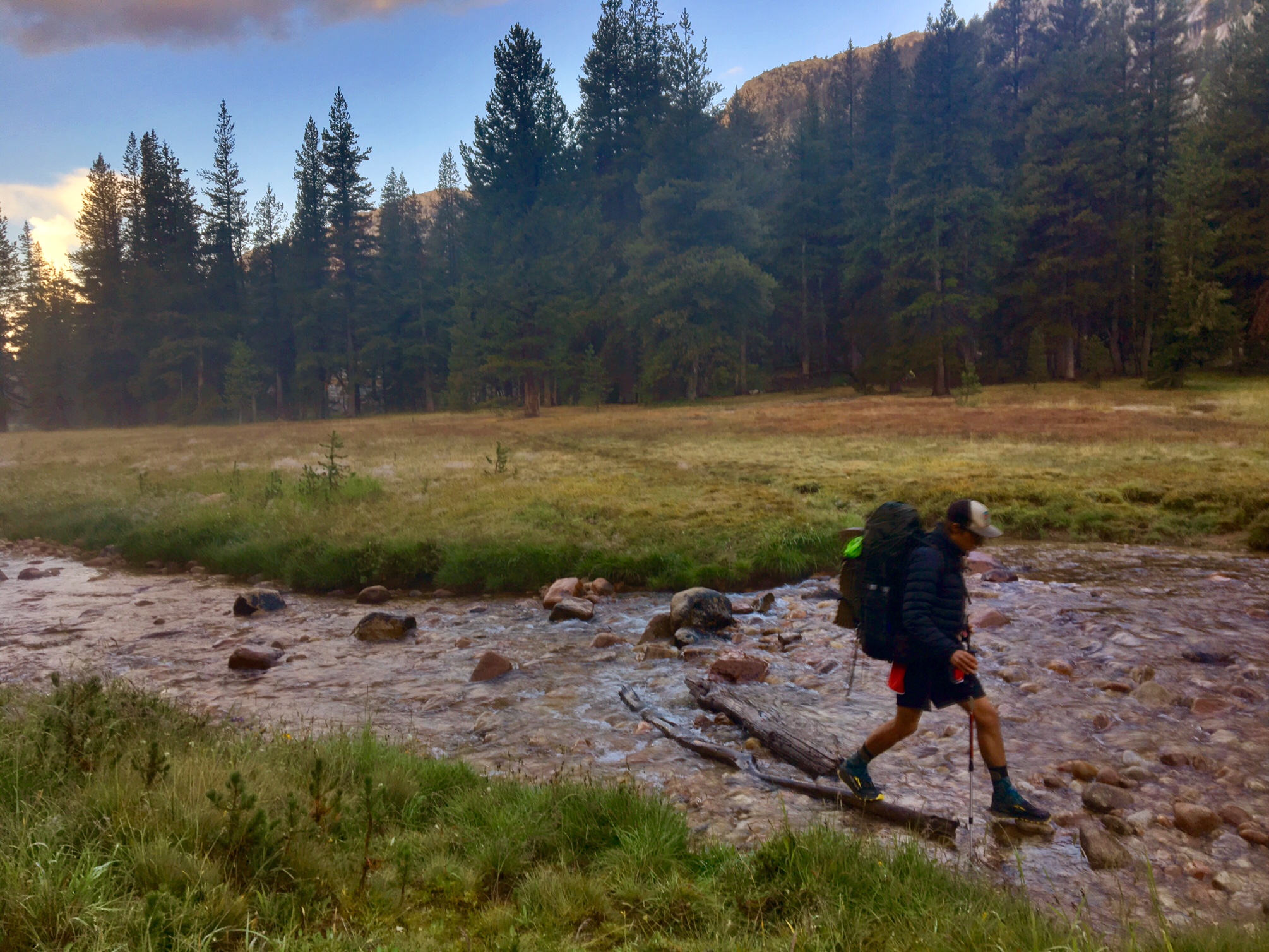
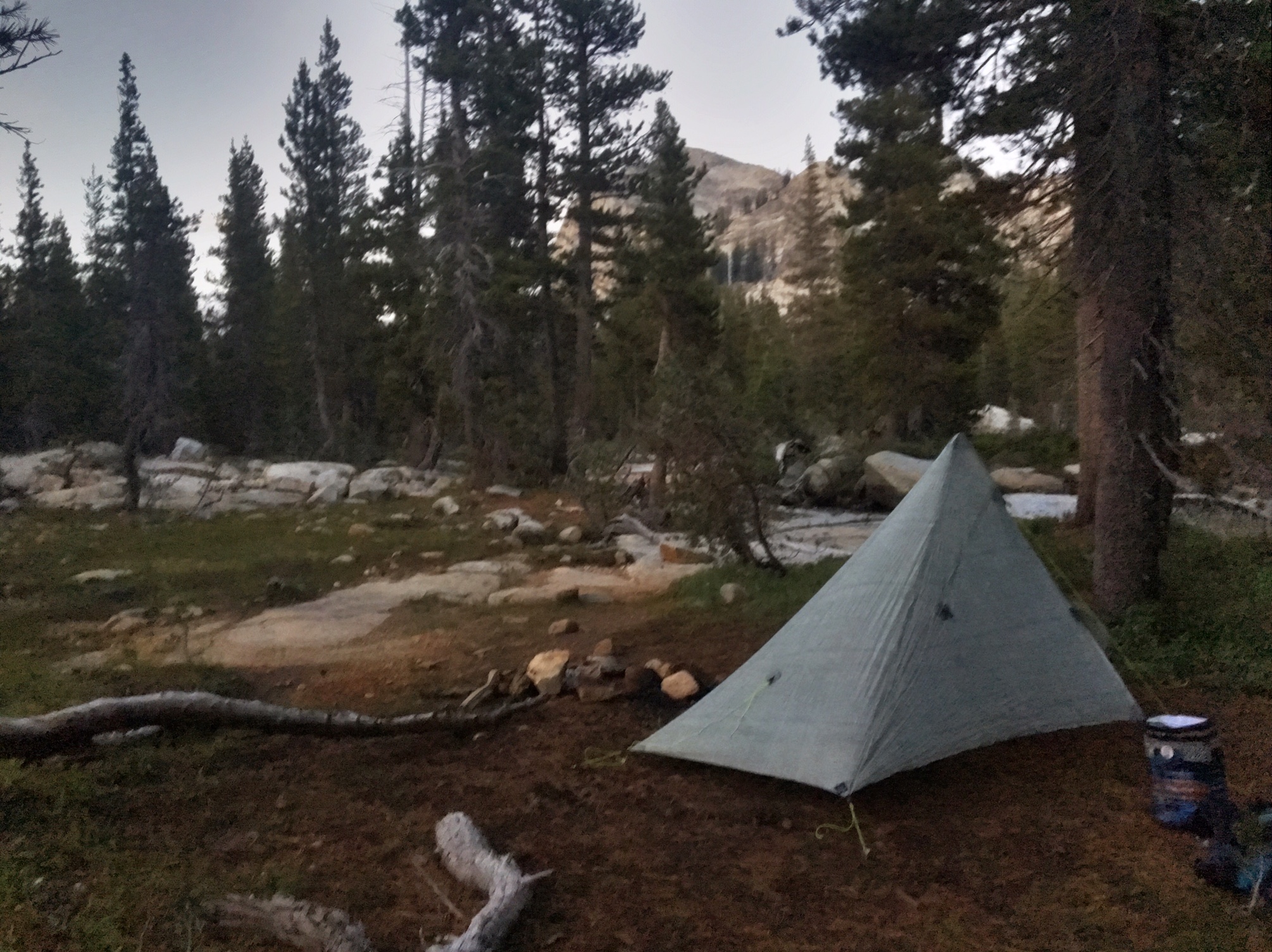
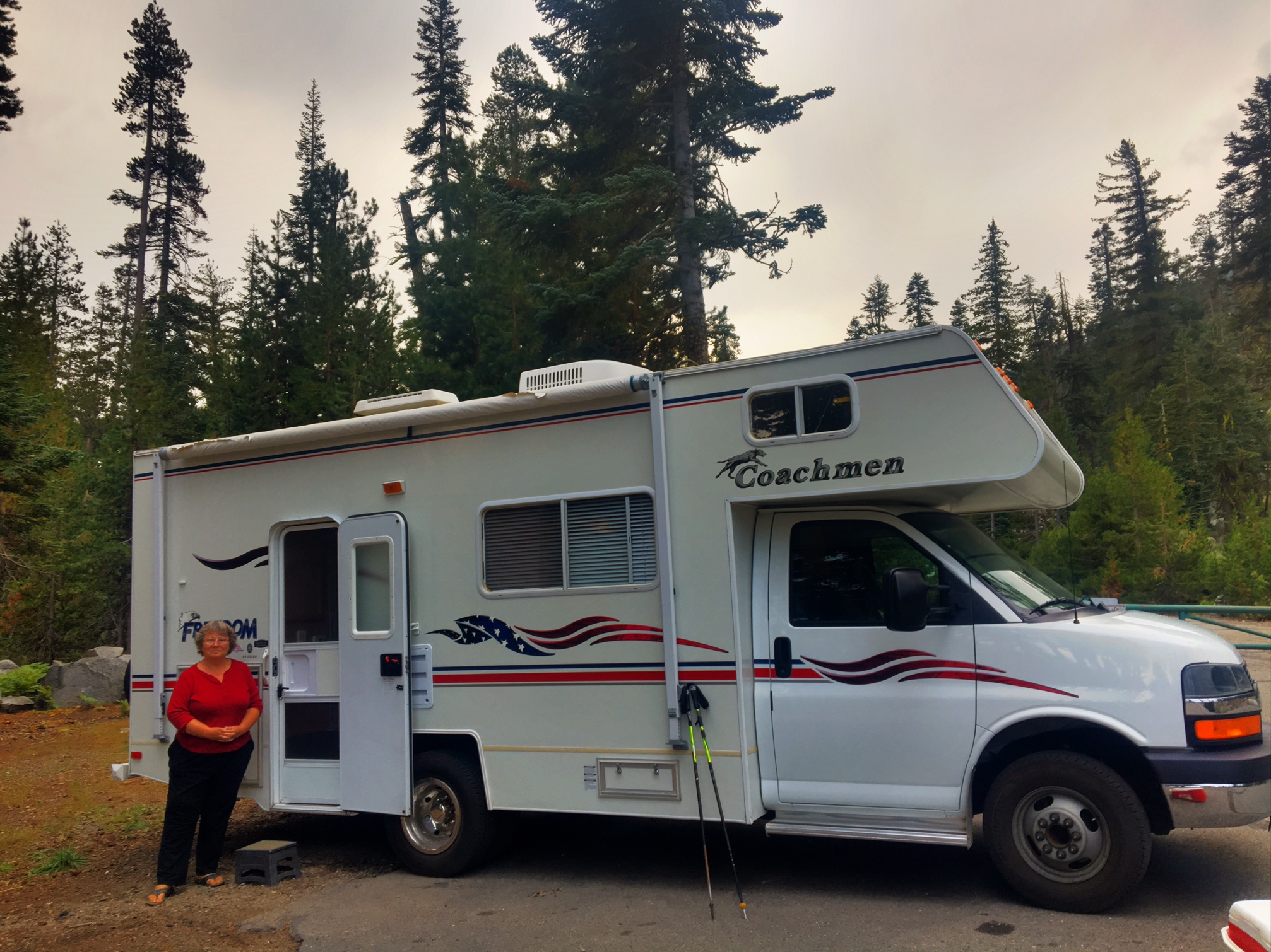
The Butcher parted ways this afternoon to push ahead and finish at Bishop Pass in three days. I hiked the rest of the day with Old Bum from Big Sky, Montana. This was our campsite. I very carefully chose a site with soft pine needles in case my mattress fix didn’t work. (Currently, it’s now a slow leak). 

This was our view over Lake Virginia.

Tomorrow will be a shorter day into my last resupply at Vermillion Valley Resort. The resupply box was sent back at the end of May when I had was still planning to arrive here mid-June. I’ve emailed them with my new planned arrival date. So hopefully, the box is still there with nothing worse than some moldy tortillas to deal with (they have a small camp store to buy any additional items).

I have just about 100 miles to go plus a little extra to hike off trail to town…2550 miles completed!

Day 108, 9/14, Shadow Lake Jct, M-916, 26mi

It was a cold at night and a slow morning getting ready. Thankfully, the skies were clear.

There was still plenty of frozen hail covering the ground.


The Lyell Fork River looking spooky first thing in the morning.

Lyell Canyon is a real treasure in Yosemite NP.

Donahue Peak on the horizon with Donahue Pass and the trail obscured to the left.

Drying out gear on top of the Pass.

Banner and Ritter Peaks

1000 Island Lake.

Garnet Lake

Today’s route and the rest of the trail I’ll be doing basically follows the John Muir Trail. There are a lot more people on trail than I’ve seen in a while… mostly JMT hikers.

My body and legs definitely did not have their normal energy/power. Hopefully, a good nights rest cures that problem. Perhaps it was the cold/wet energy sapping weather last night ?

Day 107, 9/13, to Yosemite Valley, M-942, 16mi

The Butcher and I walked out to the road around 7:15am to hitch a 10 mile ride to the Tenaya Lake trailhead. It took about 45mins to get a hitch (not much traffic) from a nice German couple. Our hike would take us over Clouds Rest (~10,000′) which would give us one of the best views of Half Dome anywhere in Yosemite. Clouds Rest is about 1000′ higher and only a couple miles away.

The final part of the climb is along a very narrow spine with incredible views.
Here is The Butcher making the final approach up to Clouds Rest.

Our first peek of Half Dome and Yosemite Valley.

A little hazy from some fires to the West.

I had a visitor as we relaxed and enjoyed the view.

The descent was just as fun as we headed down to Yosemite Valley, 6000′ below.

…more great views of Half Dome on the way down.

We passed by Nevada Falls…

…and then Vernal Falls on the aptly named “Mist Trail”

When we got to the Village we caught a free shuttle to the Post Office then stopped at the Village store/ grill. We bumped into Bullfrog who had hitched a ride down to meet up with his parents who were visiting from Lake George, NY. Very conveniently for us they were going to be driving back up to Tuolumne and offered us a ride. Four of us stinky hikers jammed into the back of a Subaru with packs on our laps. (Old Bum, Butcher, Bullfrog, and me).

The skies cut loose on the 1.5 hour drive back to Tuolumne.

There was several inches of hail on the ground at the Campground when we arrived around 6:00. Luckily, the worst of it cleared out while we were in a warm, dry car !

Hopefully, the trail dries out tomorrow before too long. Just walking through the campsite we were dodging very cold pools of water/hail.

Day 106, 9/12, Tuolumne Meadow, M-942, 22mi

It absolutely poured last night, accompanied by thunder and lightning. Luckily our campsite was protected among the trees. Needless to say, it was a little slower getting ready this morning with gear being wet and cold.

The broad Matterhorn Creek valley was a great way to start the morning.

The Butcher adeptly using rocks and logs to cross Matterhorn Creek.

A doe with two fawns scoping us out.

I love hiking through giant meadows.

The Tuolumne River passing granite walls and domes.

Tuolumne Falls is no joke.

Up above the falls the river couldn’t be more placid and gentle.

The Butcher excited for some snacks and sodas at the Tuolumne Store.

Hanging out at the hiker campsite. We even went to a Ranger campfire talk about the creation of the National Park Service.

The plan tomorrow is do a little side trip to Yosemite Valley..The Butcher decided to come along as well. We will hitch a ride to a trailhead 10 miles down the road. Then we will hike over Clouds Rest which has incredible views of Half Dome before descending 6000′ into the valley. Then we will to need to hitch about 50 miles back to Tuolumne.

Day 105, 9/11, Matterhorn Creek, M-963, 27mi

Today was one of the tougher days I’ve had in a while. The miles came more slowly… a combination of steeper than normal climbs (6700′ up) and the fact that I’m starting to lose some of my power after so many miles. On top of that there were five “wet” creek crossings as well as a pretty solid afternoon thunderstorm. Luckily, the storm cleared out just as the trail was cresting the highest Pass of the day.

A classic Yosemite granite dome as the sun rises.

This is Wide Creek. Other than getting wet feet (shin high) it was a non-issue… much different story 2.5 months ago when I would have come through originally. The pics/vids I saw had people swimming across in fast moving water. There were a total of five crossings like this today, from ankle deep to just below the knees.

The signage Yosemite uses on the trails is very distinct.

Even around mid-day the skies were still behaving…

…not so much in the afternoon.

Then things cleared just as I got to the top of Benson Pass (10,100′)
Hard to imagine seeing some blue skies again after the storm earlier.

Tomorrow, Tuolumne Meadows!

Day 104, 9/10, Falls Creek, M-990, 27mi

Today’s transition from the volcanic landscapes of Sonora Pass to the granite domes and walls of Yosemite National Park was sudden and dramatic.

This is the main building at the Kennedy Meadows Ranch. I slept upstairs and had breakfast at 6:00 with the ranch-hands.

All the horses at the ranch were eating their breakfast too.

The hitch back up to the trail was rough. A grand total of 3 cars went by in 45 minutes…and by that time there were four of us looking for a ride. Luckily, Mrs. Focus came to the rescue! She was heading back up to the Pass to set up camp and wait for her husband hiking through the next day.

Lots of snow on the peaks as we climbed toward Sonora Pass.

I was happy and surprised to run into Steve and Diane going Northbound today. We had originally met back in Tehachapi and then were hiking around each other through the northern half of Oregon. They are doing a flip-flop-flip. Since they are from Canada they really wanted to end their hike at the terminus so they headed back to the Sierras to finish that before going back up to Northern Washington to finish the last 60 miles to the border. They get high marks for all their transportation logistics planning!

There were a couple of significant snow patches today. Sonora Pass is known for its sketchy slopes in June /July even in a normal snow year.

The Butcher near the top of Sonora Pass.
The long sweeping switchbacks down volcanic scree toward Kennedy Creek.

Then a gentle climb up Dorothy Pass takes us to the incredible granite domes and alpine lakes of Yosemite.

Dorothy Lake.

The trail followed the broad Falls Creek valley most of the evening.

I found a perfect little tent site around 7:15pm near the creek just as the sun was setting.

2448 trail miles completed
202 miles to go

Day 103, 9/9, Kennedy Meadows North, M-1017, 14mi

It was fairly cold this morning…probably upper 30’s when I got out of my tent at 6:00. It gradually warmed up into the 60’s and then got cooler as the trail climbed to ~10,500′.

Wildflowers and mountain creeks never get old…

…nor do wildflowers and selfies.

The clouds started building up by mid-day. This is my first view toward Yosemite (about 15 miles south).

Within five minutes after descending down to Sonora Pass who should pull up? Mrs. Focus and Molly the RV. She was kind enough to give me and a hiker from Slovakia a ride 10 miles down the mountain to the Kennedy Meadows North Pack Station (KMN). It was a white-knuckle descent down a narrow-windy mountain road in a big-heavy camper van.

KMN is one stop shopping for all your horseback adventures. Plus they have cabins, showers, laundry, a cafe and a general store. They offer hikers a package deal including a bed in a bunk room (I was the only one). After making a pint of ice cream disappear I sorted through my resupply box and got everything else organized. One of the reasons I send most of my resupplies ahead. are $6.69 Nutter Butters. I still give them plenty of money for things I don’t send (ice cream, soda, etc).
Look who I ran into…Gilligan & Mongoose !
I last saw them leaving the comfort of our plush hotel room in Cascade Locks, OR. I beat them to Canada by several days, but they picked up the trail again 200 miles further south than me in CA and then had to spend a long holiday weekend waiting for their bear canisters to arrive at the post office in Tahoe. We parted ways again (they headed back out in the late afternoon) but I should catch them in Tuolumne Meadows, 3 days from now.

There were a lot of “ranch” dogs wandering around the grounds. This one, named Lucy, seemed to take a liking to me.

The weather definitely seems to have entered a cycle of afternoon cloud build-up, thunder, and rain/hail if you are in the wrong place at the wrong time. Hopefully, this doesn’t make things too exciting as the trail gains higher elevations in the Sierras.

Day 102, 9/8, Boulder Creek, M-1031, 30mi

Another great sunrise to start the morning.

The peak on the left is called Nipple Top. Clear skies with a light smokey haze to start the day.

The trail climbed through desert cliffs reminiscent of Souther California.

Most of the morning the trail wound through these funky rock formations.

I’m sure this one has a name…but i don’t know what it is.

I’m still surprised and impressed by all the wild flowers hanging on into September.

By the afternoon the skies couldn’t decide whether to be threatening or clear.

These are two guys also hiking southbound…I’ve only seen two others since I got back on trail in NoCal.

I found a gorgeous campsite that had a few too many cow pies for my liking. Plus, the incessant clanging of cow bells would have driven me nuts. Lastly, not my preferred water sources in these areas. I hiked another 3 miles, crossed a barb wire fence (no more cows) and camped next to a creek 🙂

I’ve now passed 2400 trail miles and have less than 250 to go!

Day 101, 9/7, Sunset Rocks, M-1061, 28mi

It was quite the tent city last night…. I took a pic before I left this morning.

Beautiful alpine hiking.

Then the trail dropped down to a magnificent Meadow.

There was a small visitor center when I crossed the highway at Carson Pass. I really like this shirt they had for sale.

This beautiful lake unfortunately was not on the PCT. I missed a turn and hiked a little over a mile before I realized my mistake. At least I got to see the lake 🙂

Some lingering snow covering the trail. This would have been pretty sketchy back in June!

I haven’t done a selfie in a while.

I found a great campsite with a fantastic sunset view.
The sunset lasted for 30 minutes or more….

I took a lot of pics!

Day 100, 9/6, Near Echo Summit, M-1087, 28mi

Today can legitimately go into the “epic day” column. The trail started out a little underwhelming considering how much I had been hearing about the “Desolation Wilderness” area for months. Around mile 6 the trail finally opened her kimono. Way too many pics to choose from today!

Tricked you on this one…not the sun rising, but the full moon setting at 6:30am.

One of my favorite trees, the Jefferey Pine. They often remind me of Bonsai trees.

The Desolation Wilderness in all its glory! Dozens of lakes surrounded by walls of granite.

After summiting Dicks Pass (9400′) the trail descended to even more lakes.

Lake Aloha might have been my favorite.

The trail finally popped us out at the Echo Lake marina. The clouds were threatening with thunder much of the afternoon, but luckily I remained dry.
The store was shutting down for the season but let me buy 1700 calories (not pictured, the It’s It Ice Cream sandwich…yum!). Gone in 60 seconds.

This creek was noted as “Seasonal” in my guide, which should mean nice and gentle if running at all come September. Instead, i started having Sierra flashbacks. The partially submerge log (next to the boulder) I crossed is a bit obscured in the pic.

Look who was parked at the Echo Summit trailhead..Mrs. Focus (and Molly, the RV). She very kindly had a pint of Ben & Jerry’s waiting for me but after the damage I had done to the Pringle’s (et al) 30mins back I had to decline. I did manage to down a Coke while I relaxed inside. Plus, I will have a the gravitational pull of ice cream waiting for me at Sonora Pass in 75 miles …talk about some motivation!