Day 4, 7/20, 25mi, M-104: Frisco

I got a nice early start for the final 2.5mi climb to the top of Georgia Pass. Unfortunately, I was just a minutes late for the last of the sunrise. I did manage to get this cool pic.

The last look of South Park before descending to Summit County.

Wildflowers brightening up the trail.

Ominous clouds over the Ten Mile Range… this pic makes them look angrier than they actually were.

I made it to Highway 9 by 3pm and five minutes later the free Summit Stage bus took me to Frisco. Who do I run into as soon as I get off the bus? Longtime friends Jeanne and Sean with their son Max! The timing was also good because the skies cut loose shortly after I arrived.

My friend Nora put me up in her exceptionally comfy guest bed.

This is what the elevation profile so far. Approx 105mi completes and just under 20,000’ of climbing.

Tomorrow the plan is to do the next section as a day hike from Copper back to Frisco (opposite direction) with Nora and her dogs. Then on Sunday I will take the free bus to Copper and continue where I left off.

Day 1, 7/17, 29mi: Little Scraggy Camp

It’s pretty easy getting to the start of the trail from Denver. The light rail leaves from Union Station and takes about 30mins to Littleton. I was also able to convince my friend Katy (trail angel extraordinaire) to pick me up and drop me off at the trailhead 10mi away at 5:30am!

The official start of the Colorado Trail !

It was nice and cool out first thing in the morning as I followed the South Platte through the canyon (unfortunately, on a dirt road… but bikes and pedestrians only).

First wildlife of the trip.

It was surprisingly lush considering how dry it’s been…lots of berries.

Apparently, the bears like the berries too!

Then there was the exposed burn section during the heat of the day. A little later some clouds rolled in and cooled things off with some sprinkles. The clouds looked angrier with lightning to the South.

Some cool rock formations above my campsite.

My new Nemo Hornet tent 🙂

Pre-trip Training

One of the big benefits to living in Colorado is the great access to incredible training hikes… especially at altitude!

Traveling over the Ten Mike range in mid June (part of the Colorado atrail near Frisco).

Testing out the new tent (Nemo Hornet Elite) in the Gore Range (Ten Mike Range on horizon).

A hike up Herman Gulch along the Continental Divide Trail.

First Columbine of the season !

More wildflowers and some snow.

A hike around Buffalo Mtn. via Lilly Pad Lake.

Mt. Crested Butte in the distance.

The Elk Range and the 401 Trail.

Standing on the Continental Divide above King Lake in the Indian Peaks Wilderness.

Columbine everywhere !

Indian Peaks wildflower meadow.

Moose in the Gore Range: 

Mountain Goat grazing near Pawnee Pass

Coming soon (as in tomorrow!), the Colorado Trail a ~500 route that goes from just outside Denver, Colorado across the state to Durango. No permits are necessary and there are many places along the way to resupply, typically every 3-5 days.

There is a fairly short window of time to hike the whole trail as snow often presents a serious challenge well into June and some years well into July. Delay too long, and come September early season snowstorms are not uncommon.

The biggest challenges for a hike like this are: the altitude (30% less oxygen at the high points ), afternoon electrical storms with monsoon rains and hail (especially above tree line), wildfire closures (currently the last 70 miles are closed…just reopened!), and figuring out how to get home (not much public transportation and hard to nail down my timing 3 weeks out)

Some great resources to find out more about the trail are: The Colorado Trail Foundation and blogger extraordinaire, PMags  

Cell service is spotty, especially the last half of the route, so don’t despair if there are not daily blog posts coming your way.

2017 PCT Post Hike Gear List

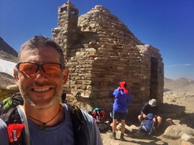
This a much delayed post that I’ve been meaning to do since I finished last September, and it’s everyone’s favorite topic …GEAR!

With the PCT Class of 2018 getting ready to hit the trail soon I figured I should finally return the favor of all my predecessors who posted their gear lists and pics.

I’m not going to get into the weight of every single item but generally, my base weight varied from 10.5lbs (in desert) to ~14.5lbs (in Sierras).
The majority of the hike I would say I was at ~11lbs. Once you add in food and water for a typical 4-5 day segment I was typically leaving town with about 22lbs (usually 1-liter of water, sometimes 2L, occasionally 3+L).

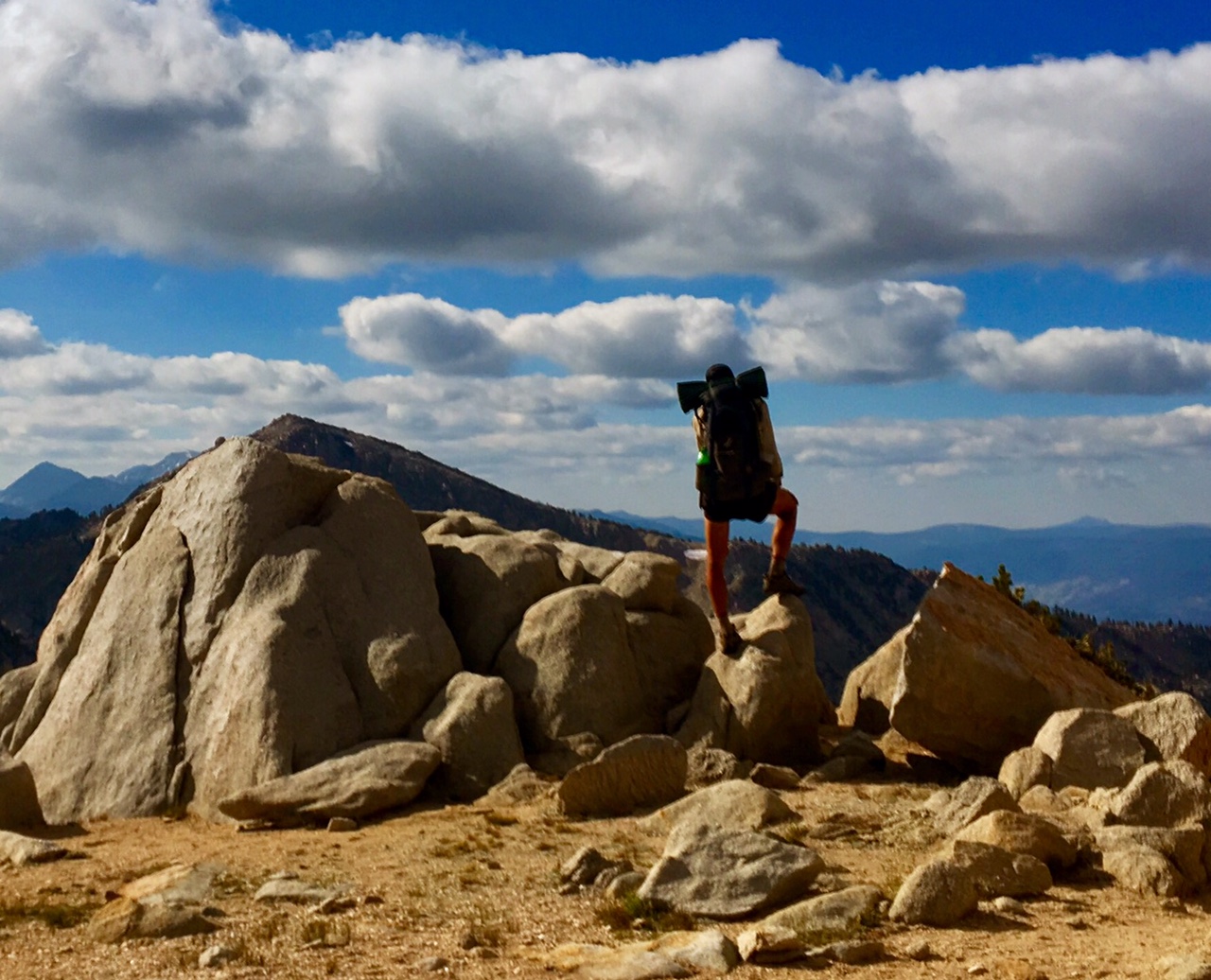
Below is a post trail pic of the gear I finished with… full details in the list at bottom.

This next pic is of the gear I had with me at some point along the way, either by design or as their usefulness changed.

A couple comments on this gear…
-My trail runners were comfortable enough that I had very little need/desire for camp shoes. I was also spending very little time “in camp” so even less of a need.
– I started in the desert with the Arcteryx running pants seen here as well as my rain skirt. There were a lot of cool mornings in May when I wore pants and only twice did I see any precipitation when I used rain skirt. I don’t like hiking in pants unless it’s really cold. When I got to the Sierras I swapped both of these for my rain pants.
-When I flipped back to the Sierras in Sept I had my 15degree sleeping bag liner sent because temps were getting colder, my sleeping bag wasn’t quite as warm after 100+ days and my body wasn’t too efficient at keeping warm (skin and bones).

This is the Grivel ice-axe/trekking pole (extendable) I used in the snowy stretches. Very similar to the Black Diamond Whippet, but this one allows the business end to retract into the handle when not needed. Luckily, I never had to self arrest but I liked that it was always in my hand… I saw a lot of dedicated ice axes living on the back of people’s packs :-/

I’m planning to do some gear specific write ups so let me know if there any particular items you’d like to hear about sooner than later.

The Full List…amazing how much stuff fits in a tiny pack!

Wearing (~$300)

Shoes: Altra Olympus

Gaiters: Altra

Socks: Darn Tough (crew-no cushion)

Compression Calf Sleeves: Zensah

T-shirt: 32 degree cool (Costco)

Shorts: North Face Running

Running hat -quick dry

Sunglasses -orange lens

Pants: Arcteryx (full zip running),

swapped to rain pants after desert

Trek poles: Fizan

Packed Gear (~1400)

Backpack: osprey exos 38

Tent: Zpacks Altalplex (hike pole- 58-60″ / 150cm)

(8-stakes: titanium/carbon: hooks, Vs)

Pole Extender for tent

Sleep Pad: Neo Air 3/4 (homemade inflator)

Sit Pad: Zrest (cut from full size)

Sleep Bag: EE Convert (20 degree, 20oz)

Sea to summit 15deg liner for Sierra

Pillow: Sea to Summit (2 oz)

Polycryo Pack liner (homemade w/inflator hardware)

Zpack Food Bag

Zpack stuffsack

Umbrella: Chrome Dome (attachment to pack)

Trowel: Deuce of spades

Bear Can: BV500 (Sierra)

Grivel Ice-axe/ trek pole (Sierra)

Micro Spikes (Sierra)

Packed clothes (~500)

Hiking sleeves: Smart Wool

Leggings: 32degrees (4oz)

Down jacket: Montbell ultralight sweater (5oz)

Long sleeve: OR Hoodie (4.5oz)

2nd hike socks: Darn Tough

Sleep socks: Possum down

Rain Skirt (changed to rain pants after desert)

Rain pants: Berghaus paclite full zip (or skirt)

Rain jacket : Berghaus VaporLight Hyper (3oz)

Glove: convertible fleece mit

Waterproof Mit: Borah (used 3x)

Buff/necker

Earband

Ski Hat (Sierras)

Bandana

Cooling towel (great in desert and NorCal)

Water/repair/Misc: (~$100)

Filter: Sawyer Squeeze

bleach drops

Water bottles: 1L-Sawyer, 1L-Smart Bottle, 2L Sawyer

Dipping cup nests on smart bottle

8oz protein shake container

Hydration tube w/bottle adapter

Spoon, knife: lexan

Micro Pocket blade (serrated)

Utility Razor blade

Head lamp: Mini Petzel

Luminaide solar light

Lighter/matches, Fire starter

-Pipe cleaners

Repair Tape (Tenacious)

Velcro for gaiters

Needle/thread

Hot Hands Handwarmers

-Head net (in resupply)

Lithium Batteries: headlamp

Sil Wallet

Sharpie

Pen

Journal

Guthook App download

iPhone (camera)

SanDisk Clip MP3 w/FM tuner (8gb)

Earbuds

Charge cord/plug (3amp)

Power Bank: Anker 10,000ma+ cord

Toiletries/Meds

Sunscreen

-Bug Deet (100%-resupply)

Nail clippers (Nail File)

Chapstick

Tooth brush/ paste

TP

Ear plugs on cord

Neosporin

Cortisone hand cream (allergy)

Advil / Naproxen/Imodium/Ambien/Allergy meds

Wet wipes

Purel

Bandaids

Leuko tape

Razor

PCT COMPLETED! Day 114, 9/20, Kearsarge Pass, 16mi, 2650+ miles

I woke up a before my alarm, a combination of excitement to be finishing the final day of the PCT and the fact that my mattress was mostly deflated, so I might as well just get up.

This final section of trail is really spectacular. Today would be the third time I’d hike through Rae Lakes and over Glenn Pass (previously on the JMT as well as a 4-day loop through Kings Canyon). I took a lot of photos since the scenery (and the lighting) were so spectacular and figured I might as well send this blog off with a bang.

An hour after sunrise the light is just starting to hit the top of distant peaks.

Reflection over Arrowhead Lake

Fin Dome

The first view of The Painted Lady

Fin Dome reflection

The Painted Lady reflection in Upper Rae Lake

The top of Glenn Pass (you can see the trail traversing across from the left).

Charlotte Dome

Technically, I completed the PCT at this junction (where I’d hike over to Kearsarge Pass and down to Onion Valley, then hitch into town) but this wouldn’t have been a very exciting place to celebrate with pictures 🙂

Bullfrog Lake view near the top of the Pass.

Similar location from when I did this back in June

Kearsarge Lakes from the top of the Pass

The Pacific Crest Trail completion celebration begins 🎉

Just in time too…look at these temps!
On the shuttle to the airport I could see the mountains were now covered in snow.

The dots represent all the places I stayed along the way. Blue dots were on trail going North. Orange were going South. Purple were off trail locations.

It was kind of odd waking up this morning (9/21/17) knowing I wouldn’t be hiking 25-30 miles today, or anytime soon. I will let things settle down for a day or two and be back with some final thoughts.

Day 113, 9/19, Baxter Creek, M-797, 29mi

I pushed pretty hard today figuring I’d rather make my final day a bit easier. The two 12,000′ passes were summited under blue skies but my legs know the end is near and weren’t giving me my normal power output (7000′ of climbing gave them their money’s worth).. .I guess they are ready for a break!

The view from Mather Pass to the North showing off the Palisade peaks (mostly 14,000’+) with Upper and Lower Palisade lakes just visible in the valley below.

The Mather Pass view looking to the South.

One of the many sapphire blue lakes on the final approach to Pinchot Pass.

The view from the top.

After a 3500′ descent the trail crossed Woods Creek on a very lively suspension bridge (sign says “one person at a time”).

I got to camp right at 7pm just as the last light was hitting the upper reaches of the peaks. It would be dark in 15 minutes.

Tomorrow is just 8 miles to the junction for Kearsarge Pass and then another 8 miles to Onion Valley Trailhead (w/ 4000′ of climbing) where I will hitch a ride 15 miles into town. If any of this sounds familiar, I did the same thing back in June when the trail was buried in snow (there’s a video of Sequoia glissading down). It should be easier to hitch a ride since there are actually people hiking the trails now that the snow is gone.

Day 112, 9/18, Palisade Creek, M-826, 28mi

Today was a classic Sierra hiking day. The trail followed a creek (Evolution Creek) upstream for many miles (16) passing alpine lakes on a series of benches. Then finally topping out on a high mountain pass… Muir Pass in this case.

 Evolution Creek cascading down the mountain.

Look who I crossed paths with this morning…
Just Bob! We met back in Tehachapi. Bob is 66 and crushes miles..i hope I’m in that kind of shape in 20+ years!
 
The sun began to warm me up as I entered Evolution Meadow.

I took a relaxing break on the shores of Evolution Lake.
This trail must have passed half a dozen or more major alpine lakes today.

 Looking back on the final approach to Muir Pass (~12,000′).

The Muir Pass hut.
It was fairly windy at the top so the shelter made a nice wind break.
The whole area is kind of a moonscape.
There was still some small snowfields to cross.

 After a couple thousand feet of descending it was great to see something green again.
The famous Monster Rock of the JMT. I was glad I could point out the landmark to this 10 year old Australian boy and his family who are hiking the whole JMT.

 The heart of Kings Canyon N.P.

 I was in the shadows earlier than normal today because the canyon walls are so steep.
I was glad to find an unoccupied campsite around 6:45 because there are quite a few JMT hikers out here. It’s getting fairly dark by 7:15 now.

So, tomorrow will be my last night on trail. Kind of hard to believe! The trail won’t be taking it easy on me just because I’m almost done. I have four more major passes (all ~12,000′ high) to go over in these last two days with 11,000′ of climbing.

Day 111, 9/17, Aspen Meadows, 30mi

Apparently, I still have a slow leak in my mattress. I re-inflated it three times in the middle of the night.. definitely more comfortable than nothing (like the night before)!

The morning started with a 2.5mi walk down a forest service road to get to the trailhead for Bear Creek which would take me back to the PCT. All-in I think it was about a 6mi detour to resupply at VVR.

 A gorgeous meadow next to Bear Creek.

View near the top of Selden Pass (~11,000′).

I decided to make the short detour to Muir Trail Ranch. They are known for the vast quantities of stuff hikers leave behind after sending their resupplies. The goodies are organized by type (i.e. oatmeal, batteries, toiletries, etc) in Home Depot buckets. I picked up much needed lip balm (still in packaging).

Shortly after the stop at MTR the trail entered Kings Canyon National Park.

I had a feeling I might catch my Swiss friends (they hadn’t stopped at VVR). Sure enough, they were camped at just the spot where I had decided on calling it a day (~7:00pm). It’s always nice seeing a familiar face when you get to camp 🙂

I was surprised I didn’t take more pics today since the scenery is so spectacular on this stretch through the high Sierras. I think it’s too overwhelming to capture suitable images. Even a 360 panorama wouldn’t do it justice.

Day 110, 9/16, Vermillion Valley Resort , M-875, 17mi

It was a cold night…especially, since my mattress didn’t hold air 😦 There was frost on the outside of my tent and small puddles were frozen on the trail.

This morning’s view over Lake Virginia.

Old Bum climbing up into the sun.

Alpine lakes near Silver Pass.

There was still quite a bit of snow hiking over Goodale Pass (Elevation 10,700′)

Old Bum enjoying the views.

We arrived at the Vermillion Valley Resort around 1:30….they are very hiker friendly.
Lots of John Muir Trail hikers use this as a stop over as …
There hiker box is chock-full’o stuff.

The Old Bum is in need of a shower.

My resupply box has been waiting for me here since June 13th…amazingly, the tortillas were fine and had no mold! 

I spent most of the afternoon searching for (and patching) five more holes I found on my mattress.

I ran into Keychain and Wildcat who I first met back in June at Kersarge Pass and then hiked with them for several days in Northern Oregon.

Only three more nights to go!